Durham night lights from space
Night Light of Durham (England) from space (United Kingdom) Src. Average luminocity for 10x10km area is 34.2607% and for 50x50km: 25.7588%.
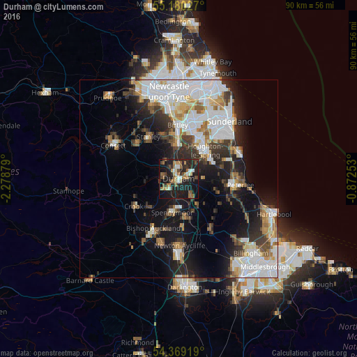
Analysis of Durham night lights 2016
Square area 10x10 km:
 3.26%
3.26%90-99
3.38%80-89
2.88%70-79
5.14%60-69
7.39%50-59
5.26%40-49
4.76%30-39
5.01%20-29
17.29%10-19
36.09%0-9
9.52%Square area 50x50 km:
7.61%90-99
5.41%80-89
1.99%70-79
2.32%60-69
2.72%50-59
2.37%40-49
2.44%30-39
3.83%20-29
5.66%10-19
11.8%0-9
53.86%Clear (daylight) street map image can be seen on geolist.org.
Map coordinates:
55° 10' 49" North, 2° 16' 43.6" West
54° 46' 36.3" North, 1° 34' 32.4" West
54° 22' 9.1" North, 0° 52' 21.1" West
Some cities around Durham sort by population:
• Houghton-Le-Spring
10 km =6.2 mi,  45°
45°
• Chester-le-Street
9.1 km =5.7 mi,  0°
0°
• Spennymoor
8.8 km =5.5 mi,  191°
191°
• Hetton-Le-Hole
9.2 km =5.7 mi,  61°
61°
• Brandon
4 km =2.5 mi,  221°
221°
• Ushaw Moor
4.6 km =2.9 mi,  271°
271°
• Sacriston
5.5 km =3.4 mi,  325°
325°
• Willington
10.4 km =6.5 mi,  230°
230°
2650628 (p: 47,785)
Sources (retrieved 2019-11-25):
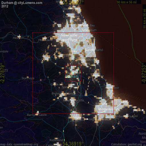
» Earth at Night: Flat Maps 2012, 2016