Willington night lights from space
Night Light of Willington (England) from space (United Kingdom) Src. Average luminocity for 10x10km area is 9.3133% and for 50x50km: 17.3247%.
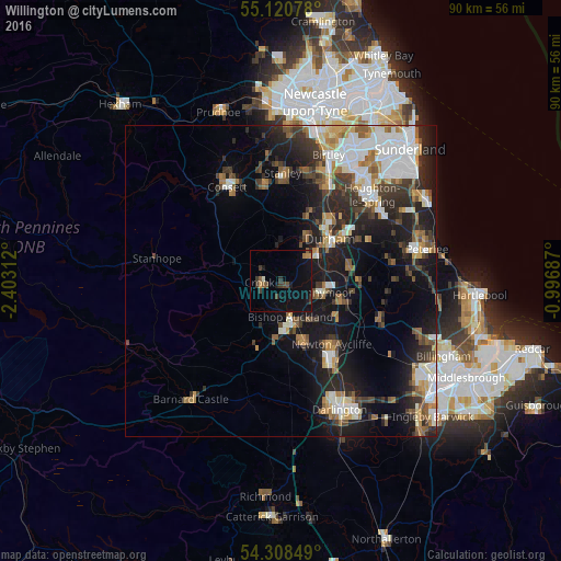
Analysis of Willington night lights 2016
Square area 10x10 km:
 0%
0%90-99
0.5%80-89
0%70-79
1.13%60-69
0.88%50-59
1.63%40-49
1.75%30-39
3.63%20-29
0.75%10-19
12.91%0-9
76.82%Square area 50x50 km:
3.53%90-99
3.11%80-89
1.18%70-79
1.65%60-69
2.27%50-59
2.26%40-49
2.18%30-39
3.35%20-29
5.14%10-19
11.42%0-9
63.91%Clear (daylight) street map image can be seen on geolist.org.
Map coordinates:
55° 7' 14.8" North, 2° 24' 11.2" West
54° 43' 0" North, 1° 42' 0" West
54° 18' 30.6" North, 0° 59' 48.7" West
Some cities around Willington sort by population:
• Durham
10.4 km =6.5 mi,  50°
50°
• Bishop Auckland
7 km =4.3 mi,  167°
167°
• Spennymoor
6.6 km =4.1 mi,  107°
107°
• Shildon
10.3 km =6.4 mi,  159°
159°
• Ferryhill
10.3 km =6.4 mi, 111°
• Brandon
6.5 km =4 mi,  55°
55°
• Crook
3.2 km =2 mi,  261°
261°
• Ushaw Moor
7.6 km =4.7 mi,  26°
26°
2633896 (p: 6,633)
Sources (retrieved 2019-11-25):
» Earth at Night: Flat Maps 2012, 2016