Chester-le-Street night lights from space
Night Light of Chester-le-Street (England) from space (United Kingdom) Src. Average luminocity for 10x10km area is 48.4462% and for 50x50km: 25.6914%.
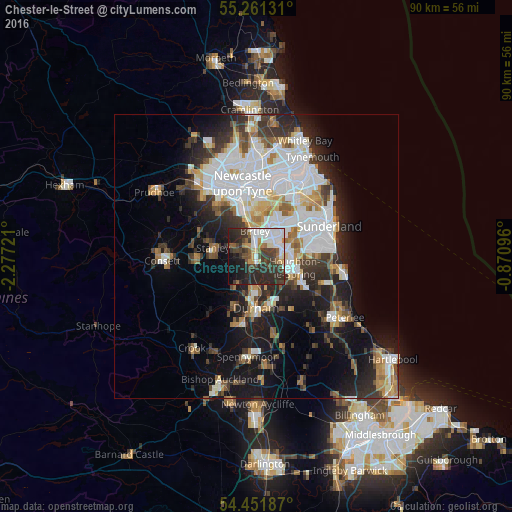
Analysis of Chester-le-Street night lights 2016
Square area 10x10 km:
 10.89%
90-99
11.12%80-89
2.39%70-79
3.59%60-69
3.59%50-59
4.31%40-49
10.41%30-39
15.55%20-29
21.77%10-19
12.56%0-9
3.83%Square area 50x50 km:
7.49%90-99
5.37%80-89
1.93%70-79
2.22%60-69
2.67%50-59
2.46%40-49
2.45%30-39
4.5%20-29
6.25%10-19
11.18%0-9
53.5%Clear (daylight) street map image can be seen on geolist.org.
Map coordinates:
55° 15' 40.7" North, 2° 16' 38" West
54° 51' 31" North, 1° 34' 26.7" West
54° 27' 6.7" North, 0° 52' 15.5" West
Some cities around Chester-le-Street sort by population:
• Washington
5.9 km =3.7 mi,  38°
38°
• Durham
9.1 km =5.7 mi,  180°
180°
• Houghton-Le-Spring
7.3 km =4.5 mi,  106°
106°
• Stanley
8 km =5 mi,  277°
277°
• Hetton-Le-Hole
9.2 km =5.7 mi,  120°
120°
• Ushaw Moor
10.1 km =6.3 mi,  207°
207°
• Sacriston
5.6 km =3.5 mi,  215°
215°
• Pelton
2.8 km =1.7 mi,  305°
305°
2653224 (p: 36,917)
Sources (retrieved 2019-11-25):
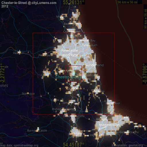
» Earth at Night: Flat Maps 2012, 2016