Darras Hall night lights from space
Night Light of Darras Hall (England) from space (United Kingdom) Src. Average luminocity for 10x10km area is 19.4937% and for 50x50km: 21.4509%.
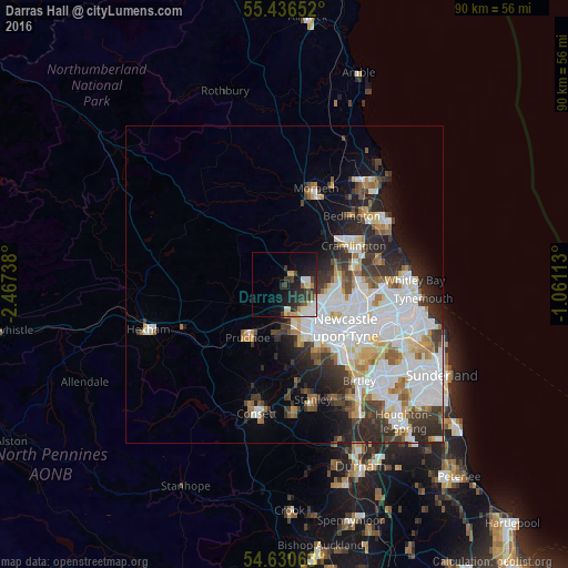
Analysis of Darras Hall night lights 2016
Square area 10x10 km:
 2.76%
2.76%90-99
3.13%80-89
2.51%70-79
3.01%60-69
0.5%50-59
0.88%40-49
2.51%30-39
6.64%20-29
7.39%10-19
14.41%0-9
56.27%Square area 50x50 km:
7.11%90-99
4.99%80-89
1.82%70-79
1.66%60-69
1.81%50-59
1.88%40-49
1.77%30-39
3.54%20-29
4.63%10-19
5.09%0-9
65.7%Clear (daylight) street map image can be seen on geolist.org.
Map coordinates:
55° 26' 11.5" North, 2° 28' 2.6" West
55° 2' 8.2" North, 1° 45' 51.3" West
54° 37' 50.3" North, 1° 3' 40.1" West
Some cities around Darras Hall sort by population:
• Newburn
5.5 km =3.4 mi,  166°
166°
• Gosforth
10.2 km =6.3 mi,  112°
112°
• Whickham
11.5 km =7.1 mi,  150°
150°
• Blaydon-on-Tyne
8.5 km =5.3 mi,  157°
157°
• Prudhoe
9.9 km =6.2 mi,  214°
214°
• Ponteland
2 km =1.2 mi,  36°
36°
• Wideopen
9.1 km =5.7 mi,  83°
83°
• Benwell
9.2 km =5.7 mi,  138°
138°
6696772 (p: 15,000)
Sources (retrieved 2019-11-25):
» Earth at Night: Flat Maps 2012, 2016