Newburn night lights from space
Night Light of Newburn (England) from space (United Kingdom) Src. Average luminocity for 10x10km area is 44.6364% and for 50x50km: 23.4482%.
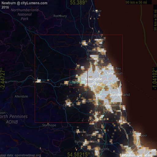
Analysis of Newburn night lights 2016
Square area 10x10 km:
 15.91%
90-99
8.61%80-89
4.31%70-79
4.9%60-69
2.99%50-59
1.56%40-49
4.67%30-39
8.85%20-29
9.21%10-19
12.92%0-9
26.08%Square area 50x50 km:
7.4%90-99
5.26%80-89
1.98%70-79
1.93%60-69
2.16%50-59
2.13%40-49
2.02%30-39
3.85%20-29
5.74%10-19
6.85%0-9
60.69%Clear (daylight) street map image can be seen on geolist.org.
Map coordinates:
55° 23' 20.4" North, 2° 26' 50.2" West
54° 59' 15.4" North, 1° 44' 38.9" West
54° 34' 55.7" North, 1° 2' 27.7" West
Some cities around Newburn sort by population:
• Gosforth
8.2 km =5.1 mi,  80°
80°
• Whickham
6.4 km =4 mi,  137°
137°
• Darras Hall
5.5 km =3.4 mi,  346°
346°
• Blaydon-on-Tyne
3.2 km =2 mi, 142°
• Prudhoe
7.4 km =4.6 mi,  247°
247°
• Ponteland
7 km =4.3 mi,  359°
359°
• Benwell
5 km =3.1 mi,  108°
108°
• Rowlands Gill
7.6 km =4.7 mi,  180°
180°
2641690 (p: 41,347)
Sources (retrieved 2019-11-25):
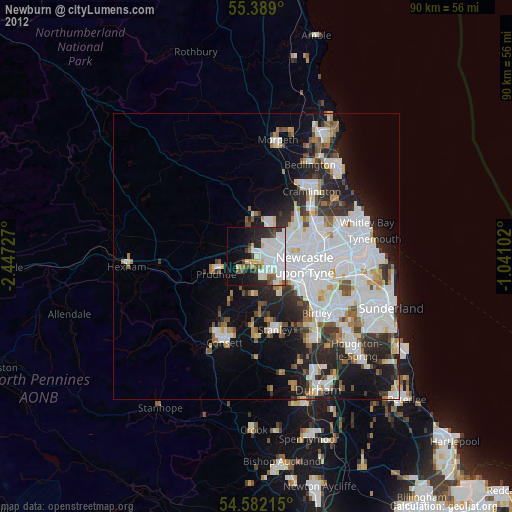
» Earth at Night: Flat Maps 2012, 2016