Crieff night lights from space
Night Light of Crieff (Scotland) from space (United Kingdom) Src. Average luminocity for 10x10km area is 1.1214% and for 50x50km: 1.3602%.
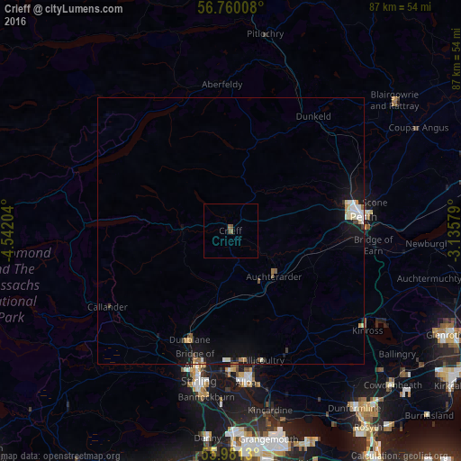
Analysis of Crieff night lights 2016
Square area 10x10 km:
 0%
0%90-99
0%80-89
0%70-79
0%60-69
0.24%50-59
1.19%40-49
0.36%30-39
0.12%20-29
0%10-19
0%0-9
98.1%Square area 50x50 km:
0.18%90-99
0.28%80-89
0.11%70-79
0.12%60-69
0.13%50-59
0.19%40-49
0.09%30-39
0.08%20-29
0.12%10-19
1.58%0-9
97.12%Clear (daylight) street map image can be seen on geolist.org.
Map coordinates:
56° 45' 36.3" North, 4° 32' 31.3" West
56° 22' 21.6" North, 3° 50' 20.1" West
55° 58' 52.7" North, 3° 8' 8.8" West
Some cities around Crieff sort by population:
• Perth
25.2 km =15.7 mi,  84°
84°
• Stirling
28.8 km =17.9 mi,  192°
192°
• Alloa
28.7 km =17.8 mi,  173°
173°
• Dunblane
21.9 km =13.6 mi,  200°
200°
• Tullibody
26.6 km =16.5 mi,  179°
179°
• Bannockburn
31.8 km =19.8 mi, 188°
• Kelty
38.5 km =23.9 mi,  133°
133°
• Tillicoultry
25.2 km =15.7 mi, 166°
2651983 (p: 7,430)
Sources (retrieved 2019-11-25):
» Earth at Night: Flat Maps 2012, 2016