Brandon night lights from space
Night Light of Brandon (England) from space (United Kingdom) Src. Average luminocity for 10x10km area is 29.3649% and for 50x50km: 19.4167%.
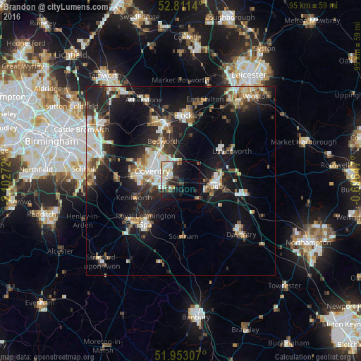
Analysis of Brandon night lights 2016
Square area 10x10 km:
 5.18%
5.18%90-99
8.59%80-89
3.54%70-79
1.89%60-69
1.01%50-59
3.28%40-49
3.03%30-39
4.92%20-29
9.97%10-19
14.77%0-9
43.81%Square area 50x50 km:
3.43%90-99
3.78%80-89
1.65%70-79
1.99%60-69
2.21%50-59
2.15%40-49
2.27%30-39
2.6%20-29
6.36%10-19
14.98%0-9
58.58%Clear (daylight) street map image can be seen on geolist.org.
Map coordinates:
52° 48' 41" North, 2° 6' 9.8" West
52° 23' 3.6" North, 1° 23' 58.6" West
51° 57' 11.1" North, 0° 41' 47.3" West
Some cities around Brandon sort by population:
• Coventry
8 km =5 mi,  287°
287°
• Royal Leamington Spa
13.7 km =8.5 mi,  216°
216°
• Rugby
9.3 km =5.8 mi,  99°
99°
• Bedworth
11.5 km =7.1 mi,  335°
335°
• Kenilworth
13 km =8.1 mi,  252°
252°
• Lutterworth
15.6 km =9.7 mi,  59°
59°
• Attleborough
14.8 km =9.2 mi,  345°
345°
• Southam
14.7 km =9.1 mi,  177°
177°
2654897 (p: 8,440)
Sources (retrieved 2019-11-25):
» Earth at Night: Flat Maps 2012, 2016