Bishopbriggs night lights from space
Night Light of Bishopbriggs (Scotland) from space (United Kingdom) Src. Average luminocity for 10x10km area is 69.2393% and for 50x50km: 29.6053%.
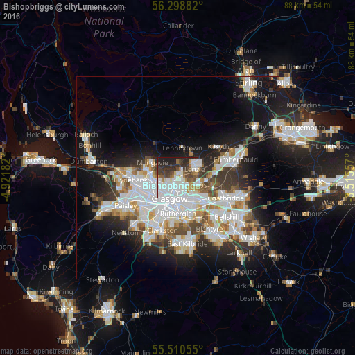
Analysis of Bishopbriggs night lights 2016
Square area 10x10 km:
 22.18%
90-99
24.69%80-89
2.88%70-79
5.51%60-69
4.76%50-59
5.76%40-49
6.64%30-39
10.4%20-29
12.53%10-19
4.64%0-9
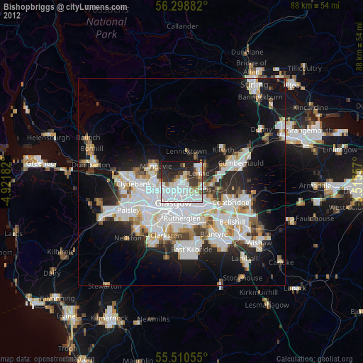
0%Square area 50x50 km:
8.26%90-99
7.47%80-89
2.03%70-79
2.81%60-69
2.95%50-59
2.55%40-49
2.97%30-39
3.83%20-29
6.34%10-19
14.27%0-9
46.51%Clear (daylight) street map image can be seen on geolist.org.
Map coordinates:
56° 17' 55.8" North, 4° 55' 18.6" West
55° 54' 24.1" North, 4° 13' 7.3" West
55° 30' 38" North, 3° 30' 56.1" West
Some cities around Bishopbriggs sort by population:
• Glasgow
5.2 km =3.2 mi,  207°
207°
• Rutherglen
8.7 km =5.4 mi,  177°
177°
• Bearsden
7.2 km =4.5 mi,  277°
277°
• Kirkintilloch
5.5 km =3.4 mi,  48°
48°
• Milngavie
7.5 km =4.7 mi,  300°
300°
• Lenzie
4.7 km =2.9 mi,  60°
60°
• Moodiesburn
8.5 km =5.3 mi,  83°
83°
• Stepps
4.6 km =2.9 mi,  115°
115°
2655582 (p: 23,430)
Sources (retrieved 2019-11-25):
» Earth at Night: Flat Maps 2012, 2016