Milngavie night lights from space
Night Light of Milngavie (Scotland) from space (United Kingdom) Src. Average luminocity for 10x10km area is 41.6767% and for 50x50km: 28.1454%.
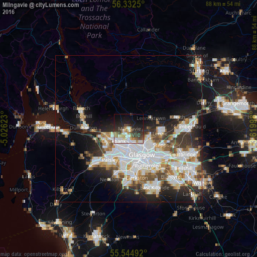
Analysis of Milngavie night lights 2016
Square area 10x10 km:
 9.65%
9.65%90-99
9.15%80-89
3.13%70-79
4.14%60-69
4.76%50-59
3.01%40-49
6.02%30-39
9.4%20-29
12.66%10-19
20.18%0-9
17.92%Square area 50x50 km:
8.09%90-99
7.31%80-89
2.02%70-79
2.79%60-69
2.81%50-59
2.53%40-49
2.75%30-39
3.62%20-29
5.52%10-19
10.41%0-9
52.15%Clear (daylight) street map image can be seen on geolist.org.
Map coordinates:
56° 19' 57" North, 5° 1' 34.4" West
55° 56' 26.6" North, 4° 19' 23.2" West
55° 32' 41.7" North, 3° 37' 11.9" West
Some cities around Milngavie sort by population:
• Glasgow
9.3 km =5.8 mi,  154°
154°
• Bearsden
2.9 km =1.8 mi,  192°
192°
• Clydebank
6.8 km =4.2 mi,  229°
229°
• Bishopbriggs
7.5 km =4.7 mi,  120°
120°
• Renfrew
8.8 km =5.5 mi,  209°
209°
• Erskine
9.1 km =5.7 mi,  240°
240°
• Duntocher
6 km =3.7 mi,  252°
252°
• Faifley
4.1 km =2.5 mi, 250°
2642484 (p: 13,110)
Sources (retrieved 2019-11-25):
» Earth at Night: Flat Maps 2012, 2016