Horsham night lights from space
Night Light of Horsham (England) from space (United Kingdom) Src. Average luminocity for 10x10km area is 14.8676% and for 50x50km: 10.459%.
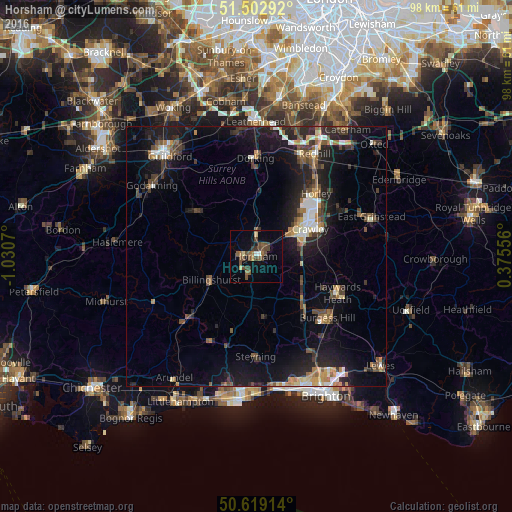
Analysis of Horsham night lights 2016
Square area 10x10 km:
 0.67%
0.67%90-99
0.4%80-89
1.6%70-79
0.53%60-69
2.27%50-59
4.95%40-49
6.55%30-39
3.34%20-29
0.27%10-19
4.28%0-9
75.13%Square area 50x50 km:
0.9%90-99
1.32%80-89
0.75%70-79
1.14%60-69
1.35%50-59
1.53%40-49
2.11%30-39
1.94%20-29
3.31%10-19
9.92%0-9
75.73%Clear (daylight) street map image can be seen on geolist.org.
Map coordinates:
51° 30' 10.5" North, 1° 1' 50.5" West
51° 3' 47.3" North, 0° 19' 39.3" West
50° 37' 8.9" North, 0° 22' 32" East
Some cities around Horsham sort by population:
• Crawley
11.5 km =7.1 mi,  61°
61°
• Broadfield
9.3 km =5.8 mi,  65°
65°
• Bewbush
8.6 km =5.3 mi, 58°
• Southwater
4.7 km =2.9 mi,  201°
201°
• Langley Green
11.6 km =7.2 mi,  51°
51°
• Billingshurst
9.9 km =6.2 mi,  243°
243°
• Furnace Green
12.1 km =7.5 mi, 66°
• Gossops Green
9.4 km =5.8 mi, 55°
2646557 (p: 51,472)
Sources (retrieved 2019-11-25):
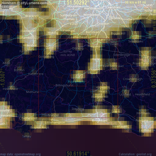
» NASA, Earths city lights 1995
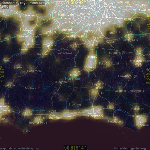
» NASA city lights 2003
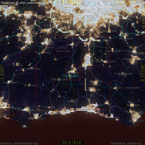
» Earth at Night: Flat Maps 2012, 2016