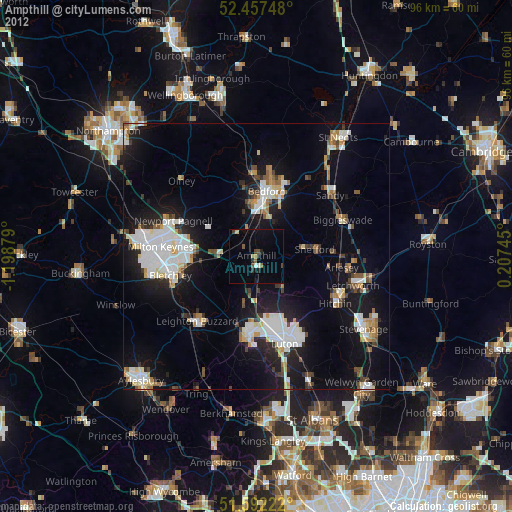
Ampthill night lights from space
Night Light of Ampthill (England) from space (United Kingdom) Src. Average luminocity for 10x10km area is 12.7662% and for 50x50km: 18.0972%.
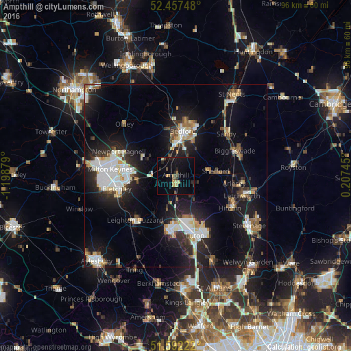
Analysis of Ampthill night lights 2016
Square area 10x10 km:
 0%
0%90-99
0%80-89
2.08%70-79
2.6%60-69
1.04%50-59
2.08%40-49
2.08%30-39
0.65%20-29
3.64%10-19
12.86%0-9
72.99%Square area 50x50 km:
3.43%90-99
3.37%80-89
1.76%70-79
1.53%60-69
1.65%50-59
1.77%40-49
1.8%30-39
2.34%20-29
5.6%10-19
15.38%0-9
61.36%Clear (daylight) street map image can be seen on geolist.org.
Map coordinates:
52° 27' 26.9" North, 1° 11' 55.6" West
52° 1' 37" North, 0° 29' 44.4" West
51° 35' 32" North, 0° 12' 26.8" East
Some cities around Ampthill sort by population:
• Bedford
12.1 km =7.5 mi,  9°
9°
• Kempston Hardwick
7 km =4.3 mi,  358°
358°
• Kempston
9.9 km =6.2 mi, 358°
• Flitwick
2.6 km =1.6 mi,  178°
178°
• Henlow
14.3 km =8.9 mi,  88°
88°
• Shefford
11.1 km =6.9 mi,  83°
83°
• Cranfield
9 km =5.6 mi,  300°
300°
• Woburn Sands
10.6 km =6.6 mi,  263°
263°
2657337 (p: 20,026)
Sources (retrieved 2019-11-25):
» Earth at Night: Flat Maps 2012, 2016