Shefford night lights from space
Night Light of Shefford (England) from space (United Kingdom) Src. Average luminocity for 10x10km area is 7.9848% and for 50x50km: 12.6078%.
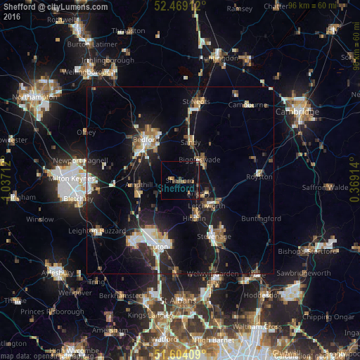
Analysis of Shefford night lights 2016
Square area 10x10 km:
 0.13%
0.13%90-99
0.13%80-89
0.13%70-79
0.51%60-69
2.02%50-59
1.52%40-49
2.4%30-39
2.15%20-29
2.27%10-19
1.89%0-9
86.87%Square area 50x50 km:
1.53%90-99
1.94%80-89
1.25%70-79
1.23%60-69
1.39%50-59
1.54%40-49
1.56%30-39
1.88%20-29
3.89%10-19
11.63%0-9
72.16%Clear (daylight) street map image can be seen on geolist.org.
Map coordinates:
52° 28' 8.8" North, 1° 2' 13.6" West
52° 2' 19.3" North, 0° 20' 2.4" West
51° 36' 14.7" North, 0° 22' 8.9" East
Some cities around Shefford sort by population:
• Letchworth Garden City
9.9 km =6.2 mi,  131°
131°
• Hitchin
10.5 km =6.5 mi,  161°
161°
• Letchworth
9.8 km =6.1 mi, 132°
• Biggleswade
7.1 km =4.4 mi,  41°
41°
• Henlow
3.4 km =2.1 mi,  106°
106°
• Sandy
10.5 km =6.5 mi,  16°
16°
• Stotfold
7.4 km =4.6 mi, 109°
• Arlesey
5.8 km =3.6 mi, 126°
2638074 (p: 10,816)
Sources (retrieved 2019-11-25):
» Earth at Night: Flat Maps 2012, 2016