Ballynahinch night lights from space
Night Light of Ballynahinch (Northern Ireland) from space (United Kingdom) Src. Average luminocity for 10x10km area is 2.4031% and for 50x50km: 8.3897%.
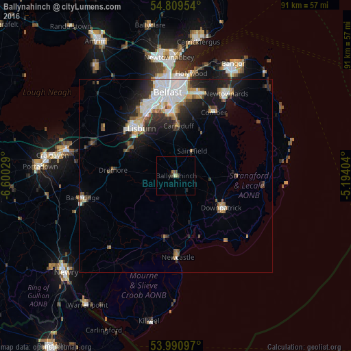
Analysis of Ballynahinch night lights 2016
Square area 10x10 km:
 0%
0%90-99
0.48%80-89
0%70-79
0.48%60-69
0.48%50-59
0.48%40-49
0.48%30-39
0.96%20-29
0.96%10-19
0%0-9
95.69%Square area 50x50 km:
1.98%90-99
1.91%80-89
0.47%70-79
0.9%60-69
0.84%50-59
0.89%40-49
0.77%30-39
1.14%20-29
2.42%10-19
4.57%0-9
84.1%Clear (daylight) street map image can be seen on geolist.org.
Map coordinates:
54° 48' 34.3" North, 6° 36' 1" West
54° 24' 8.3" North, 5° 53' 49.8" West
53° 59' 27.5" North, 5° 11' 38.5" West
Some cities around Ballynahinch sort by population:
• Belfast
21.7 km =13.5 mi,  355°
355°
• Lisburn
16.2 km =10.1 mi,  326°
326°
• Castlereagh
19.1 km =11.9 mi,  2°
2°
• Dundonald
22 km =13.7 mi,  16°
16°
• Downpatrick
14.4 km =8.9 mi,  124°
124°
• Comber
19.1 km =11.9 mi,  31°
31°
• Carryduff
12.9 km =8 mi, 2°
• Newcastle
20.5 km =12.7 mi,  178°
178°
2656483 (p: 5,701)
Sources (retrieved 2019-11-25):
» Earth at Night: Flat Maps 2012, 2016