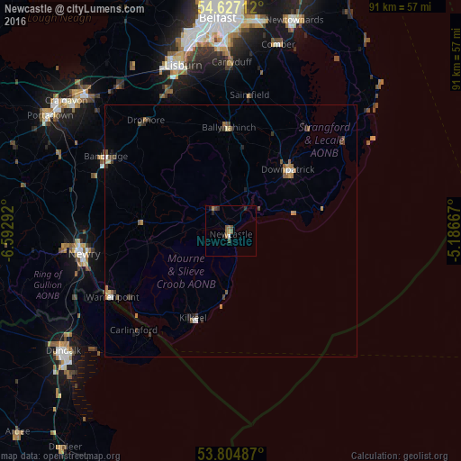
Newcastle night lights from space
Night Light of Newcastle (Northern Ireland) from space (United Kingdom) Src. Average luminocity for 10x10km area is 4.8545% and for 50x50km: 1.2883%.
Analysis of Newcastle night lights 2016
Square area 10x10 km:
 0.26%
0.26%90-99
0.26%80-89
0%70-79
1.06%60-69
0.93%50-59
1.72%40-49
1.46%30-39
0.66%20-29
1.59%10-19
0.53%0-9
91.53%Square area 50x50 km:
0.1%90-99
0.11%80-89
0.06%70-79
0.25%60-69
0.25%50-59
0.3%40-49
0.26%30-39
0.24%20-29
0.28%10-19
0.16%0-9
97.99%Clear (daylight) street map image can be seen on geolist.org.
Map coordinates:
54° 37' 37.6" North, 6° 35' 34.5" West
54° 13' 4.9" North, 5° 53' 23.2" West
53° 48' 17.5" North, 5° 11' 12" West
Some cities around Newcastle sort by population:
• Lisburn
35.2 km =21.9 mi,  344°
344°
• Newry
29.4 km =18.3 mi,  261°
261°
• Banbridge
29.5 km =18.3 mi,  299°
299°
• Downpatrick
16.7 km =10.4 mi,  42°
42°
• Carryduff
33.4 km =20.8 mi,  0°
0°
• Warrenpoint
27.2 km =16.9 mi,  241°
241°
• Kilkeel
18.9 km =11.7 mi,  203°
203°
• Ballynahinch
20.5 km =12.7 mi,  358°
358°
6695976 (p: 7,444)
Sources (retrieved 2019-11-25):
» Earth at Night: Flat Maps 2012, 2016