Aberystwyth night lights from space
Night Light of Aberystwyth (Wales) from space (United Kingdom) Src. Average luminocity for 10x10km area is 5.4419% and for 50x50km: 0.3467%.
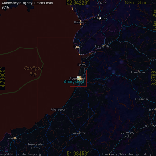
Analysis of Aberystwyth night lights 2016
Square area 10x10 km:
 0.38%
0.38%90-99
0.13%80-89
0.51%70-79
1.01%60-69
2.9%50-59
0.63%40-49
0%30-39
0%20-29
1.26%10-19
1.26%0-9
91.92%Square area 50x50 km:
0.02%90-99
0.01%80-89
0.04%70-79
0.07%60-69
0.16%50-59
0.05%40-49
0.04%30-39
0.02%20-29
0.09%10-19
0.06%0-9
99.46%Clear (daylight) street map image can be seen on geolist.org.
Map coordinates:
52° 50' 32.1" North, 4° 47' 9.8" West
52° 24' 55.7" North, 4° 4' 58.5" West
51° 59' 4.3" North, 3° 22' 47.3" West
Some cities around Aberystwyth sort by population:
• Ammanford
69.5 km =43.2 mi,  174°
174°
• Carmarthen
64.1 km =39.8 mi,  193°
193°
• Newtown
54.2 km =33.7 mi,  78°
78°
• Brecon
70.4 km =43.7 mi,  137°
137°
• Welshpool
68.9 km =42.8 mi,  66°
66°
• Brynamman
70 km =43.5 mi, 167°
• Llandrindod Wells
51.6 km =32.1 mi,  111°
111°
• Cardigan
54 km =33.6 mi,  226°
226°
2657782 (p: 18,749)
Sources (retrieved 2019-11-25):
» Earth at Night: Flat Maps 2012, 2016