Voiron night lights from space
Night Light of Voiron (Auvergne-Rhône-Alpes) from space (France) Src. Average luminocity for 10x10km area is 24.2127% and for 50x50km: 12.2193%.
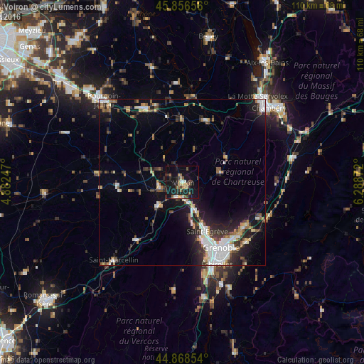
Analysis of Voiron night lights 2016
Square area 10x10 km:
 0.79%
0.79%90-99
3.17%80-89
2.22%70-79
3.97%60-69
2.86%50-59
5.4%40-49
2.54%30-39
4.6%20-29
6.35%10-19
37.62%0-9
30.48%Square area 50x50 km:
2.29%90-99
2.06%80-89
0.91%70-79
1.08%60-69
1.3%50-59
1.61%40-49
1.29%30-39
2.38%20-29
3.45%10-19
8.33%0-9
75.29%Clear (daylight) street map image can be seen on geolist.org.
Map coordinates:
45° 51' 23.6" North, 4° 52' 56.9" East
45° 21' 53" North, 5° 35' 8.2" East
44° 52' 6.7" North, 6° 17' 19.4" East
Some cities around Voiron sort by population:
• Fontaine
20.7 km =12.9 mi,  157°
157°
• Saint-Égrève
16.4 km =10.2 mi,  152°
152°
• Sassenage
18 km =11.2 mi, 160°
• Voreppe
8.6 km =5.3 mi, 155°
• Moirans
4.4 km =2.7 mi,  213°
213°
• Tullins
10.1 km =6.3 mi,  226°
226°
• Rives
6.7 km =4.2 mi,  259°
259°
• Saint-Martin-le-Vinoux
20.7 km =12.9 mi, 150°
2967758 (p: 22,114)
Sources (retrieved 2019-11-25):
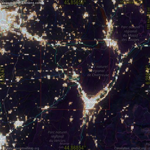
» Earth at Night: Flat Maps 2012, 2016