Tullins night lights from space
Night Light of Tullins (Auvergne-Rhône-Alpes) from space (France) Src. Average luminocity for 10x10km area is 11.8667% and for 50x50km: 10.7057%.
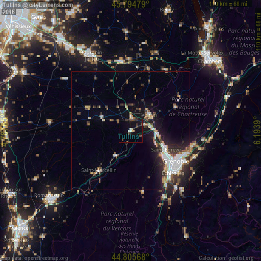
Analysis of Tullins night lights 2016
Square area 10x10 km:
 0.63%
0.63%90-99
1.27%80-89
0.63%70-79
1.27%60-69
0%50-59
2.7%40-49
3.33%30-39
2.54%20-29
2.38%10-19
13.02%0-9
72.22%Square area 50x50 km:
2.15%90-99
1.91%80-89
0.86%70-79
0.8%60-69
0.9%50-59
1.37%40-49
1.27%30-39
2.27%20-29
3.34%10-19
6.46%0-9
78.66%Clear (daylight) street map image can be seen on geolist.org.
Map coordinates:
45° 47' 41.2" North, 4° 47' 15.5" East
45° 18' 8.6" North, 5° 29' 26.8" East
44° 48' 20.4" North, 6° 11' 38" East
Some cities around Tullins sort by population:
• Fontaine
19.7 km =12.2 mi,  128°
128°
• Voiron
10.1 km =6.3 mi,  46°
46°
• Saint-Égrève
16.8 km =10.4 mi,  117°
117°
• Sassenage
16.8 km =10.4 mi, 126°
• Voreppe
11.1 km =6.9 mi,  94°
94°
• Moirans
5.9 km =3.7 mi,  57°
57°
• Rives
5.7 km =3.5 mi,  7°
7°
• Saint-Martin-le-Vinoux
20.8 km =12.9 mi, 122°
2971480 (p: 7,689)
Sources (retrieved 2019-11-25):
» Earth at Night: Flat Maps 2012, 2016