Vitré night lights from space
Night Light of Vitré (Brittany) from space (France) Src. Average luminocity for 10x10km area is 17.1131% and for 50x50km: 2.2087%.
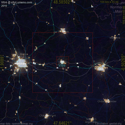
Analysis of Vitré night lights 2016
Square area 10x10 km:
 3.72%
3.72%90-99
3.42%80-89
2.08%70-79
1.93%60-69
1.19%50-59
0.15%40-49
0.6%30-39
1.19%20-29
2.38%10-19
11.01%0-9
72.32%Square area 50x50 km:
0.27%90-99
0.47%80-89
0.21%70-79
0.35%60-69
0.11%50-59
0.17%40-49
0.34%30-39
0.23%20-29
0.25%10-19
0.83%0-9
96.77%Clear (daylight) street map image can be seen on geolist.org.
Map coordinates:
48° 35' 6.1" North, 1° 54' 32" West
48° 7' 3.9" North, 1° 12' 20.8" West
47° 38' 46.4" North, 0° 30' 9.5" West
Some cities around Vitré sort by population:
• Fougères
26 km =16.2 mi,  0°
0°
• Liffré
24.8 km =15.4 mi,  295°
295°
• Saint-Berthevin
28.2 km =17.5 mi,  101°
101°
• Fouillard
28.1 km =17.5 mi,  279°
279°
• Châteaugiron
23.6 km =14.7 mi,  250°
250°
• Janzé
28 km =17.4 mi,  230°
230°
• Acigné
24.6 km =15.3 mi,  274°
274°
• Châteaubourg
14.5 km =9 mi, 267°
2967879 (p: 17,266)
Sources (retrieved 2019-11-25):
» Earth at Night: Flat Maps 2012, 2016