Acigné night lights from space
Night Light of Acigné (Brittany) from space (France) Src. Average luminocity for 10x10km area is 11.7188% and for 50x50km: 6.6807%.
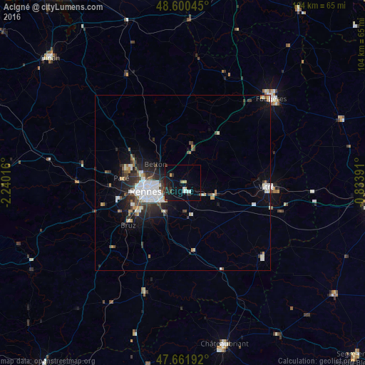
Analysis of Acigné night lights 2016
Square area 10x10 km:
 1.34%
1.34%90-99
1.64%80-89
1.79%70-79
0.6%60-69
0.6%50-59
0%40-49
0.89%30-39
1.19%20-29
3.27%10-19
13.39%0-9
75.3%Square area 50x50 km:
1.69%90-99
1.2%80-89
0.43%70-79
0.5%60-69
0.37%50-59
0.61%40-49
0.92%30-39
1.12%20-29
2.07%10-19
3.89%0-9
87.19%Clear (daylight) street map image can be seen on geolist.org.
Map coordinates:
48° 36' 1.6" North, 2° 14' 24.6" West
48° 7' 60" North, 1° 32' 13.3" West
47° 39' 42.9" North, 0° 50' 2.1" West
Some cities around Acigné sort by population:
• Rennes
10.5 km =6.5 mi,  256°
256°
• Cesson-Sévigné
5.1 km =3.2 mi,  254°
254°
• Betton
9.2 km =5.7 mi,  304°
304°
• Chantepie
7.6 km =4.7 mi,  229°
229°
• Liffré
9.1 km =5.7 mi,  13°
13°
• Fouillard
4.2 km =2.6 mi,  311°
311°
• Châteaugiron
10 km =6.2 mi,  165°
165°
• Châteaubourg
10.5 km =6.5 mi,  103°
103°
3038698 (p: 5,746)
Sources (retrieved 2019-11-25):
» Earth at Night: Flat Maps 2012, 2016