Verneuil-sur-Avre night lights from space
Night Light of Verneuil-sur-Avre (Normandy) from space (France) Src. Average luminocity for 10x10km area is 8.1071% and for 50x50km: 1.4326%.
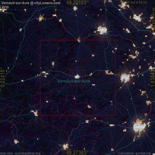
Analysis of Verneuil-sur-Avre night lights 2016
Square area 10x10 km:
 1.04%
1.04%90-99
2.53%80-89
1.19%70-79
1.19%60-69
0.15%50-59
0.45%40-49
0.6%30-39
0.6%20-29
0%10-19
0%0-9
92.26%Square area 50x50 km:
0.15%90-99
0.26%80-89
0.14%70-79
0.19%60-69
0.19%50-59
0.18%40-49
0.29%30-39
0.25%20-29
0.16%10-19
0.2%0-9
97.99%Clear (daylight) street map image can be seen on geolist.org.
Map coordinates:
49° 12' 3.8" North, 0° 13' 27" East
48° 44' 22.2" North, 0° 55' 38.3" East
48° 16' 25.1" North, 1° 37' 49.5" East
Some cities around Verneuil-sur-Avre sort by population:
• Évreux
35.6 km =22.1 mi,  27°
27°
• Dreux
32.1 km =19.9 mi,  90°
90°
• Lucé
51.8 km =32.2 mi,  130°
130°
• Nogent-le-Rotrou
47.1 km =29.3 mi,  189°
189°
• Bernay
45.7 km =28.4 mi,  328°
328°
• Vernouillet
32.5 km =20.2 mi, 93°
• Mainvilliers
50.5 km =31.4 mi, 129°
• Pacy-sur-Eure
45.4 km =28.2 mi,  47°
47°
2969799 (p: 7,229)
Sources (retrieved 2019-11-25):
» Earth at Night: Flat Maps 2012, 2016