Lucé night lights from space
Night Light of Lucé (Centre) from space (France) Src. Average luminocity for 10x10km area is 50.9091% and for 50x50km: 5.3455%.
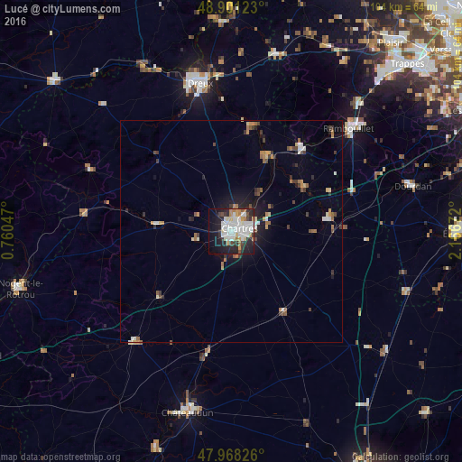
Analysis of Lucé night lights 2016
Square area 10x10 km:
 15.48%
90-99
14.91%80-89
3.84%70-79
4.55%60-69
4.4%50-59
0.85%40-49
3.84%30-39
4.69%20-29
16.62%10-19
21.02%0-9
9.8%Square area 50x50 km:
0.82%90-99
0.95%80-89
0.47%70-79
0.55%60-69
0.75%50-59
0.47%40-49
0.63%30-39
0.77%20-29
1.33%10-19
2.97%0-9
90.28%Clear (daylight) street map image can be seen on geolist.org.
Map coordinates:
48° 54' 4.4" North, 0° 45' 37.7" East
48° 26' 12.8" North, 1° 27' 48.9" East
47° 58' 5.7" North, 2° 10' 0.2" East
Some cities around Lucé sort by population:
• Chartres
2.2 km =1.4 mi,  59°
59°
• Dreux
34.1 km =21.2 mi,  347°
347°
• Rambouillet
35.4 km =22 mi,  49°
49°
• Vernouillet
32.3 km =20.1 mi, 347°
• Mainvilliers
1.6 km =1 mi,  339°
339°
• Luisant
1.1 km =0.7 mi,  137°
137°
• Saint-Arnoult-en-Yvelines
38.1 km =23.7 mi,  66°
66°
• Épernon
24.7 km =15.3 mi,  38°
38°
2997246 (p: 17,780)
Sources (retrieved 2019-11-25):
» Earth at Night: Flat Maps 2012, 2016