Beaucourt night lights from space
Night Light of Beaucourt (Bourgogne-Franche-Comté) from space (France) Src. Average luminocity for 10x10km area is 28.9446% and for 50x50km: 11.2089%.
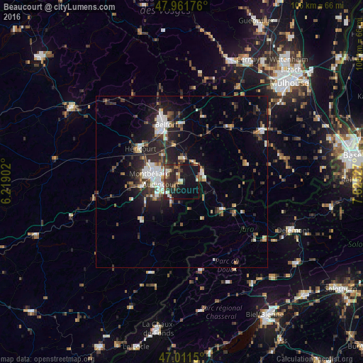
Analysis of Beaucourt night lights 2016
Square area 10x10 km:
 2.41%
2.41%90-99
4.55%80-89
4.26%70-79
2.13%60-69
2.13%50-59
2.7%40-49
7.1%30-39
4.69%20-29
15.91%10-19
33.52%0-9
20.6%Square area 50x50 km:
1.68%90-99
1.97%80-89
0.94%70-79
0.75%60-69
0.84%50-59
1.48%40-49
1.83%30-39
2.15%20-29
4.39%10-19
7.97%0-9
75.99%Clear (daylight) street map image can be seen on geolist.org.
Map coordinates:
47° 57' 42.3" North, 6° 13' 8.5" East
47° 29' 19.6" North, 6° 55' 19.7" East
47° 0' 41.4" North, 7° 37' 31" East
Some cities around Beaucourt sort by population:
• Montbéliard
9.6 km =6 mi,  283°
283°
• Audincourt
5.2 km =3.2 mi,  263°
263°
• Valentigney
7.3 km =4.5 mi,  247°
247°
• Bethoncourt
10.2 km =6.3 mi,  300°
300°
• Delle
6.2 km =3.9 mi,  69°
69°
• Seloncourt
6 km =3.7 mi,  237°
237°
• Mandeure
9.7 km =6 mi, 242°
• Grand-Charmont
8.4 km =5.2 mi, 300°
3034343 (p: 5,565)
Sources (retrieved 2019-11-25):
» Earth at Night: Flat Maps 2012, 2016