La Chapelle-sur-Erdre night lights from space
Night Light of La Chapelle-sur-Erdre (Pays de la Loire) from space (France) Src. Average luminocity for 10x10km area is 52.2574% and for 50x50km: 15.2263%.
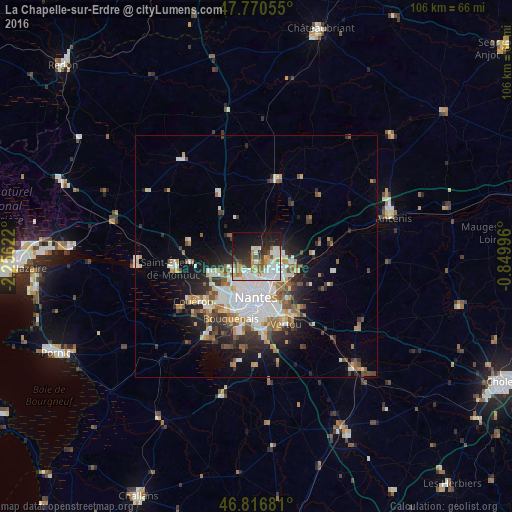
Analysis of La Chapelle-sur-Erdre night lights 2016
Square area 10x10 km:
 14.88%
90-99
13.84%80-89
2.53%70-79
5.06%60-69
7.74%50-59
4.91%40-49
4.32%30-39
6.55%20-29
11.9%10-19
21.28%0-9
6.99%Square area 50x50 km:
3.84%90-99
3%80-89
1.12%70-79
1.5%60-69
1.85%50-59
1.86%40-49
1.83%30-39
1.78%20-29
3.65%10-19
6.61%0-9
72.97%Clear (daylight) street map image can be seen on geolist.org.
Map coordinates:
47° 46' 14" North, 2° 15' 22.4" West
47° 17' 45" North, 1° 33' 11.1" West
46° 49' 0.5" North, 0° 50' 59.9" West
Some cities around La Chapelle-sur-Erdre sort by population:
• Nantes
8.7 km =5.4 mi,  180°
180°
• Orvault
5.9 km =3.7 mi,  241°
241°
• Carquefou
4.7 km =2.9 mi,  86°
86°
• Sainte-Luce-sur-Loire
7 km =4.3 mi,  131°
131°
• Sautron
9.6 km =6 mi,  247°
247°
• Thouaré-sur-Loire
9.2 km =5.7 mi,  109°
109°
• Treillières
6.3 km =3.9 mi,  307°
307°
• Sucé-sur-Erdre
4.4 km =2.7 mi,  19°
19°
3010237 (p: 18,481)
Sources (retrieved 2019-11-25):
» Earth at Night: Flat Maps 2012, 2016