Sucy-en-Brie night lights from space
Night Light of Sucy-en-Brie (Île-de-France) from space (France) Src. Average luminocity for 10x10km area is 83.7898% and for 50x50km: 65.5278%.
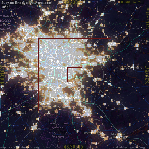
Analysis of Sucy-en-Brie night lights 2016
Square area 10x10 km:
 38.92%
90-99
18.75%80-89
6.96%70-79
12.93%60-69
5.4%50-59
5.11%40-49
8.1%30-39
3.84%20-29
0%10-19
0%0-9
0%Square area 50x50 km:
32.24%90-99
15.66%80-89
3.9%70-79
4.25%60-69
4.48%50-59
3.46%40-49
4.25%30-39
4.99%20-29
6.53%10-19
7.28%0-9
12.97%Clear (daylight) street map image can be seen on geolist.org.
Map coordinates:
49° 13' 48" North, 1° 49' 53.8" East
48° 46' 7.4" North, 2° 32' 5.1" East
48° 18' 11.3" North, 3° 14' 16.3" East
Some cities around Sucy-en-Brie sort by population:
• Saint-Maur-des-Fossés
4.1 km =2.5 mi,  312°
312°
• Limeil-Brévannes
4.4 km =2.7 mi,  232°
232°
• Bonneuil-sur-Marne
4.1 km =2.5 mi,  271°
271°
• Chennevières-sur-Marne
3.2 km =2 mi,  7°
7°
• Boissy-Saint-Léger
2.6 km =1.6 mi,  221°
221°
• La Queue-en-Brie
3.9 km =2.4 mi,  61°
61°
• Ormesson-sur-Marne
2.1 km =1.3 mi,  20°
20°
• Villecresnes
5.4 km =3.4 mi,  176°
176°
2973745 (p: 25,014)
Sources (retrieved 2019-11-25):
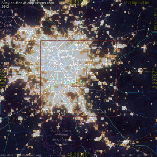
» Earth at Night: Flat Maps 2012, 2016