Saint-Quentin-Fallavier night lights from space
Night Light of Saint-Quentin-Fallavier (Auvergne-Rhône-Alpes) from space (France) Src. Average luminocity for 10x10km area is 49.9591% and for 50x50km: 30.603%.
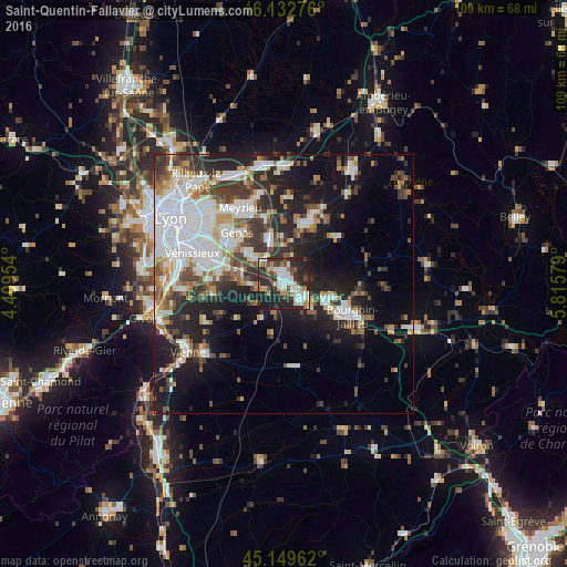
Analysis of Saint-Quentin-Fallavier night lights 2016
Square area 10x10 km:
 10.3%
10.3%90-99
11.97%80-89
2.88%70-79
6.52%60-69
4.85%50-59
4.39%40-49
6.67%30-39
9.24%20-29
29.09%10-19
14.09%0-9
0%Square area 50x50 km:
8.13%90-99
6.3%80-89
2.15%70-79
2.81%60-69
3.12%50-59
3.78%40-49
3.73%30-39
5%20-29
8.38%10-19
14.3%0-9
42.3%Clear (daylight) street map image can be seen on geolist.org.
Map coordinates:
46° 7' 57.9" North, 4° 24' 34.3" East
45° 38' 36.1" North, 5° 6' 45.6" East
45° 8' 58.6" North, 5° 48' 56.8" East
Some cities around Saint-Quentin-Fallavier sort by population:
• Bourgoin-Jallieu
14 km =8.7 mi,  116°
116°
• Villefontaine
4.5 km =2.8 mi,  139°
139°
• Genas
13 km =8.1 mi,  318°
318°
• L’Isle-d’Abeau
9.1 km =5.7 mi,  106°
106°
• Mions
12.6 km =7.8 mi,  279°
279°
• Charvieu-Chavagneux
12.2 km =7.6 mi,  13°
13°
• La Verpillière
2.8 km =1.7 mi, 111°
• Tignieu
13.4 km =8.3 mi,  26°
26°
2977277 (p: 6,302)
Sources (retrieved 2019-11-25):
» Earth at Night: Flat Maps 2012, 2016