Saint-Ouen night lights from space
Night Light of Saint-Ouen (Île-de-France) from space (France) Src. Average luminocity for 10x10km area is 99.8224% and for 50x50km: 74.0251%.
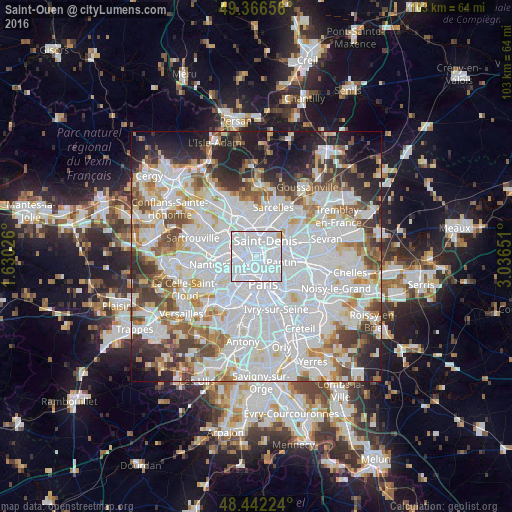
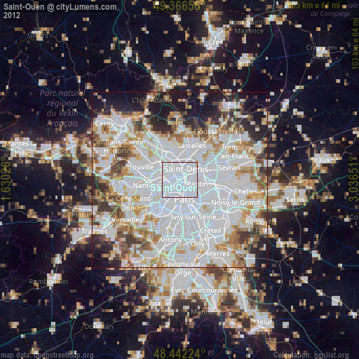
Analysis of Saint-Ouen night lights 2016
Square area 10x10 km:
 96.59%
90-99
2.56%80-89
0.85%70-79
0%60-69
0%50-59
0%40-49
0%30-39
0%20-29
0%10-19
0%0-9
0%Square area 50x50 km:
34.62%90-99
18.28%80-89
5.53%70-79
4.79%60-69
5.79%50-59
4.95%40-49
5.64%30-39
5.18%20-29
6.22%10-19
7.03%0-9
1.97%Clear (daylight) street map image can be seen on geolist.org.
Map coordinates:
49° 21' 59.6" North, 1° 37' 48.9" East
48° 54' 23.5" North, 2° 20' 0.2" East
48° 26' 32.1" North, 3° 2' 11.4" East
Some cities around Saint-Ouen sort by population:
• Asnières-sur-Seine
3.8 km =2.4 mi,  287°
287°
• Aubervilliers
3.8 km =2.4 mi,  72°
72°
• Levallois-Perret
3.6 km =2.2 mi,  246°
246°
• Clichy
1.9 km =1.2 mi, 247°
• Gennevilliers
3.9 km =2.4 mi,  320°
320°
• La Courneuve
5.2 km =3.2 mi,  62°
62°
• Bois-Colombes
4.5 km =2.8 mi, 288°
• Villeneuve-la-Garenne
3.9 km =2.4 mi,  339°
339°
2977824 (p: 39,353)
Sources (retrieved 2019-11-25):
» Earth at Night: Flat Maps 2012, 2016