Clichy night lights from space
Night Light of Clichy (Île-de-France) from space (France) Src. Average luminocity for 10x10km area is 99.8523% and for 50x50km: 74.5755%.

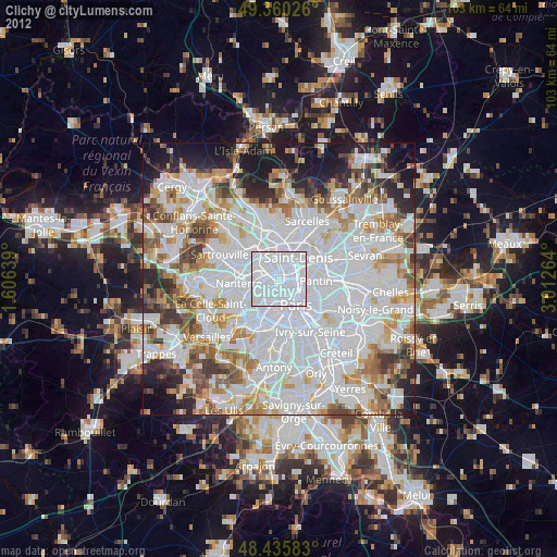
Analysis of Clichy night lights 2016
Square area 10x10 km:
 94.6%
94.6%90-99
5.11%80-89
0.28%70-79
0%60-69
0%50-59
0%40-49
0%30-39
0%20-29
0%10-19
0%0-9
0%Square area 50x50 km:
34.99%90-99
18.4%80-89
5.5%70-79
4.83%60-69
5.9%50-59
4.93%40-49
5.76%30-39
5.23%20-29
6.34%10-19
6.44%0-9
1.67%Clear (daylight) street map image can be seen on geolist.org.
Map coordinates:
49° 21' 36.9" North, 1° 36' 23" East
48° 54' 0.6" North, 2° 18' 34.3" East
48° 26' 9" North, 3° 0' 45.5" East
Some cities around Clichy sort by population:
• Asnières-sur-Seine
2.7 km =1.7 mi,  313°
313°
• Courbevoie
3.9 km =2.4 mi,  264°
264°
• Levallois-Perret
1.7 km =1.1 mi,  245°
245°
• Neuilly-sur-Seine
3.4 km =2.1 mi,  239°
239°
• Gennevilliers
3.8 km =2.4 mi,  349°
349°
• Saint-Ouen
1.9 km =1.2 mi,  67°
67°
• Bois-Colombes
3.3 km =2.1 mi, 310°
• Villeneuve-la-Garenne
4.4 km =2.7 mi,  5°
5°
3024597 (p: 57,467)
Sources (retrieved 2019-11-25):
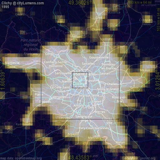
» NASA, Earths city lights 1995
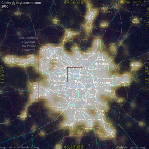
» NASA city lights 2003
» Earth at Night: Flat Maps 2012, 2016