Villeneuve-la-Garenne night lights from space
Night Light of Villeneuve-la-Garenne (Île-de-France) from space (France) Src. Average luminocity for 10x10km area is 99.7486% and for 50x50km: 70.228%.
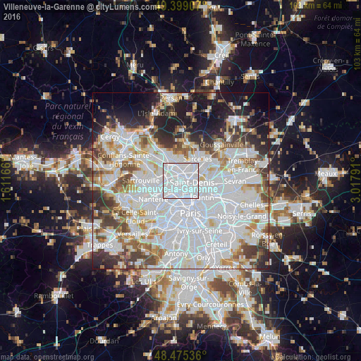
Analysis of Villeneuve-la-Garenne night lights 2016
Square area 10x10 km:
 86.36%
90-99
13.64%80-89
0%70-79
0%60-69
0%50-59
0%40-49
0%30-39
0%20-29
0%10-19
0%0-9
0%Square area 50x50 km:
32.9%90-99
16.76%80-89
5.25%70-79
4.46%60-69
5.46%50-59
4.75%40-49
5.28%30-39
5.23%20-29
6.35%10-19
8.75%0-9
4.82%Clear (daylight) street map image can be seen on geolist.org.
Map coordinates:
49° 23' 56.7" North, 1° 36' 42" East
48° 56' 21.7" North, 2° 18' 53.2" East
48° 28' 31.3" North, 3° 1' 4.5" East
Some cities around Villeneuve-la-Garenne sort by population:
• Saint-Denis
2.9 km =1.8 mi,  98°
98°
• Asnières-sur-Seine
3.4 km =2.1 mi,  222°
222°
• Épinay-sur-Seine
1.6 km =1 mi,  0°
0°
• Gennevilliers
1.3 km =0.8 mi,  238°
238°
• Saint-Ouen
3.9 km =2.4 mi,  159°
159°
• Bois-Colombes
3.7 km =2.3 mi,  232°
232°
• Deuil-la-Barre
4.3 km =2.7 mi,  12°
12°
• Enghien-les-Bains
3 km =1.9 mi, 2°
2968555 (p: 22,036)
Sources (retrieved 2019-11-25):
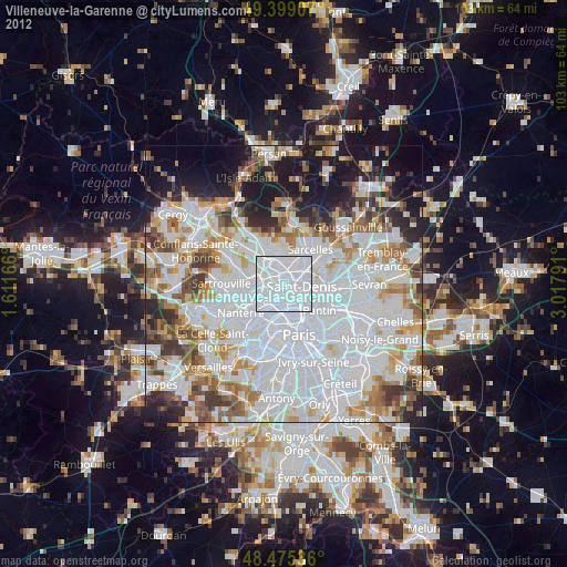
» Earth at Night: Flat Maps 2012, 2016