Saint-Loubès night lights from space
Night Light of Saint-Loubès (Nouvelle-Aquitaine) from space (France) Src. Average luminocity for 10x10km area is 42.6683% and for 50x50km: 27.0569%.
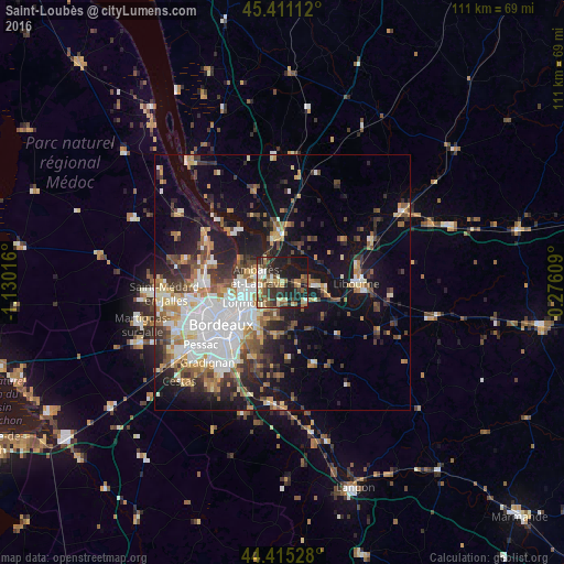
Analysis of Saint-Loubès night lights 2016
Square area 10x10 km:
 2.54%
2.54%90-99
6.35%80-89
8.1%70-79
2.38%60-69
10.63%50-59
5.24%40-49
9.21%30-39
9.05%20-29
18.73%10-19
26.98%0-9
0.79%Square area 50x50 km:
5.9%90-99
4.73%80-89
2.74%70-79
2.83%60-69
3.62%50-59
3.24%40-49
3.75%30-39
3.95%20-29
6.35%10-19
14.66%0-9
48.22%Clear (daylight) street map image can be seen on geolist.org.
Map coordinates:
45° 24' 40" North, 1° 7' 48.6" West
44° 54' 55.3" North, 0° 25' 37.3" West
44° 24' 55" North, 0° 16' 33.9" East
Some cities around Saint-Loubès sort by population:
• Le Bouscat
14.3 km =8.9 mi,  247°
247°
• Lormont
8.4 km =5.2 mi,  237°
237°
• Cenon
9.8 km =6.1 mi,  227°
227°
• Floirac
11.5 km =7.1 mi,  216°
216°
• Ambarès-et-Lagrave
4.4 km =2.7 mi,  271°
271°
• Bassens
7.2 km =4.5 mi,  258°
258°
• Carbon-Blanc
6.2 km =3.9 mi, 250°
• Artigues-près-Bordeaux
10.1 km =6.3 mi, 224°
2978749 (p: 7,678)
Sources (retrieved 2019-11-25):
» Earth at Night: Flat Maps 2012, 2016