Roncq night lights from space
Night Light of Roncq (Hauts-de-France) from space (France) Src. Average luminocity for 10x10km area is 82.9465% and for 50x50km: 45.335%.
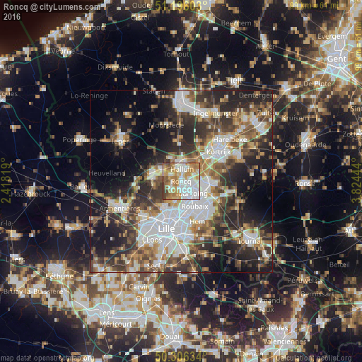
Analysis of Roncq night lights 2016
Square area 10x10 km:
 30.35%
90-99
17.78%80-89
10.16%70-79
16.31%60-69
14.04%50-59
5.21%40-49
4.28%30-39
1.87%20-29
0%10-19
0%0-9
0%Square area 50x50 km:
10.88%90-99
8.51%80-89
3.95%70-79
4.88%60-69
6.18%50-59
7%40-49
6.73%30-39
7.92%20-29
12.46%10-19
14.3%0-9
17.18%Clear (daylight) street map image can be seen on geolist.org.
Map coordinates:
51° 11' 45.7" North, 2° 25' 5.5" East
50° 45' 11.9" North, 3° 7' 16.7" East
50° 18' 22.8" North, 3° 49' 28" East
Some cities around Roncq sort by population:
• Tourcoing
4.3 km =2.7 mi,  139°
139°
• Mouscron, BE
6.1 km =3.8 mi,  98°
98°
• Menen, BE
4.9 km =3 mi,  0°
0°
• Wevelgem, BE
6.1 km =3.8 mi,  31°
31°
• Halluin
3.7 km =2.3 mi,  5°
5°
• Bondues
6 km =3.7 mi,  197°
197°
• Neuville-en-Ferrain
2.6 km =1.6 mi, 102°
• Linselles
3.5 km =2.2 mi,  238°
238°
2982938 (p: 13,387)
Sources (retrieved 2019-11-25):
» Earth at Night: Flat Maps 2012, 2016