Raismes night lights from space
Night Light of Raismes (Hauts-de-France) from space (France) Src. Average luminocity for 10x10km area is 65.1779% and for 50x50km: 27.8115%.
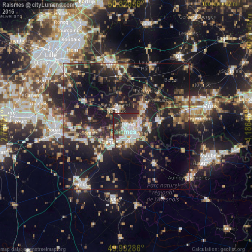
Analysis of Raismes night lights 2016
Square area 10x10 km:
 20.45%
90-99
19.47%80-89
5.18%70-79
4.2%60-69
3.92%50-59
5.46%40-49
4.76%30-39
15.97%20-29
20.45%10-19
0.14%0-9
0%Square area 50x50 km:
3.42%90-99
4.49%80-89
2.51%70-79
2.4%60-69
3.83%50-59
3.82%40-49
4.91%30-39
5.48%20-29
11.91%10-19
22.95%0-9
34.27%Clear (daylight) street map image can be seen on geolist.org.
Map coordinates:
50° 49' 46.4" North, 2° 46' 48.8" East
50° 22' 60" North, 3° 28' 60" East
49° 55' 58.3" North, 4° 11' 11.3" East
Some cities around Raismes sort by population:
• Valenciennes
4 km =2.5 mi,  132°
132°
• Anzin
1.9 km =1.2 mi, 130°
• Bruay-sur-l’Escaut
4.6 km =2.9 mi,  67°
67°
• Marly
6.3 km =3.9 mi, 131°
• Saint-Saulve
5.3 km =3.3 mi,  104°
104°
• Aulnoy-lez-Valenciennes
6.6 km =4.1 mi,  147°
147°
• Beuvrages
0.8 km =0.5 mi,  83°
83°
• Petite-Forêt
1.9 km =1.2 mi,  180°
180°
2984537 (p: 13,719)
Sources (retrieved 2019-11-25):
» Earth at Night: Flat Maps 2012, 2016