Marly night lights from space
Night Light of Marly (Hauts-de-France) from space (France) Src. Average luminocity for 10x10km area is 66.0532% and for 50x50km: 26.3327%.
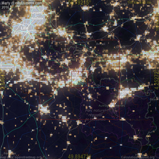
Analysis of Marly night lights 2016
Square area 10x10 km:
 22.97%
90-99
18.35%80-89
8.54%70-79
4.48%60-69
4.76%50-59
3.36%40-49
3.22%30-39
9.1%20-29
14.43%10-19
10.78%0-9
0%Square area 50x50 km:
3.3%90-99
4.23%80-89
2.52%70-79
2.46%60-69
3.26%50-59
3.77%40-49
4.27%30-39
4.75%20-29
11.09%10-19
22.52%0-9
37.84%Clear (daylight) street map image can be seen on geolist.org.
Map coordinates:
50° 47' 31.7" North, 2° 50' 47.3" East
50° 20' 44" North, 3° 32' 58.5" East
49° 53' 41" North, 4° 15' 9.8" East
Some cities around Marly sort by population:
• Valenciennes
2.3 km =1.4 mi,  310°
310°
• Anzin
4.4 km =2.7 mi, 312°
• Saint-Saulve
2.9 km =1.8 mi,  9°
9°
• Onnaing
5.7 km =3.5 mi,  38°
38°
• Aulnoy-lez-Valenciennes
1.8 km =1.1 mi,  220°
220°
• Beuvrages
5.8 km =3.6 mi,  317°
317°
• Trith-Saint-Léger
5.7 km =3.5 mi,  235°
235°
• Petite-Forêt
5.3 km =3.3 mi,  296°
296°
2995656 (p: 11,681)
Sources (retrieved 2019-11-25):
» Earth at Night: Flat Maps 2012, 2016