Anzin night lights from space
Night Light of Anzin (Hauts-de-France) from space (France) Src. Average luminocity for 10x10km area is 78.4888% and for 50x50km: 26.917%.
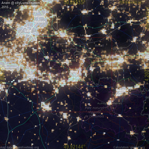
Analysis of Anzin night lights 2016
Square area 10x10 km:
 28.71%
90-99
26.75%80-89
6.86%70-79
5.04%60-69
4.62%50-59
6.86%40-49
4.62%30-39
10.64%20-29
5.88%10-19
0%0-9
0%Square area 50x50 km:
3.19%90-99
4.27%80-89
2.53%70-79
2.41%60-69
3.52%50-59
3.65%40-49
4.66%30-39
5.27%20-29
11.59%10-19
23.28%0-9
35.63%Clear (daylight) street map image can be seen on geolist.org.
Map coordinates:
50° 49' 6.1" North, 2° 48' 2.7" East
50° 22' 19.2" North, 3° 30' 13.9" East
49° 55' 17.2" North, 4° 12' 25.2" East
Some cities around Anzin sort by population:
• Valenciennes
2.1 km =1.3 mi,  133°
133°
• Raismes
1.9 km =1.2 mi,  310°
310°
• Bruay-sur-l’Escaut
4.1 km =2.5 mi,  43°
43°
• Marly
4.4 km =2.7 mi, 132°
• Saint-Saulve
3.7 km =2.3 mi,  91°
91°
• Aulnoy-lez-Valenciennes
4.8 km =3 mi,  154°
154°
• Beuvrages
1.5 km =0.9 mi,  333°
333°
• Petite-Forêt
1.6 km =1 mi,  247°
247°
3037397 (p: 14,443)
Sources (retrieved 2019-11-25):
» Earth at Night: Flat Maps 2012, 2016