Parempuyre night lights from space
Night Light of Parempuyre (Nouvelle-Aquitaine) from space (France) Src. Average luminocity for 10x10km area is 46.7032% and for 50x50km: 26.234%.
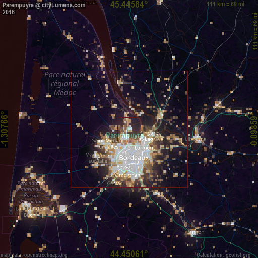
Analysis of Parempuyre night lights 2016
Square area 10x10 km:
 6.03%
6.03%90-99
8.1%80-89
3.65%70-79
1.27%60-69
10.16%50-59
10.79%40-49
9.68%30-39
13.49%20-29
19.68%10-19
17.14%0-9
0%Square area 50x50 km:
5.91%90-99
4.91%80-89
2.68%70-79
2.72%60-69
3.55%50-59
2.98%40-49
3.52%30-39
3.67%20-29
6.15%10-19
12.13%0-9
51.77%Clear (daylight) street map image can be seen on geolist.org.
Map coordinates:
45° 26' 45" North, 1° 18' 27.6" West
44° 57' 1.4" North, 0° 36' 16.3" West
44° 27' 2.2" North, 0° 5' 54.9" East
Some cities around Parempuyre sort by population:
• Le Bouscat
9.4 km =5.8 mi,  175°
175°
• Eysines
8.1 km =5 mi,  204°
204°
• Blanquefort
4.9 km =3 mi,  210°
210°
• Bruges
7.9 km =4.9 mi, 184°
• Le Taillan-Médoc
7.2 km =4.5 mi,  226°
226°
• Bassens
8.8 km =5.5 mi,  127°
127°
• Carbon-Blanc
10.1 km =6.3 mi, 126°
• Le Pian-Médoc
4.6 km =2.9 mi,  276°
276°
2988548 (p: 7,143)
Sources (retrieved 2019-11-25):
» Earth at Night: Flat Maps 2012, 2016