Le Pian-Médoc night lights from space
Night Light of Le Pian-Médoc (Nouvelle-Aquitaine) from space (France) Src. Average luminocity for 10x10km area is 43.8349% and for 50x50km: 25.325%.
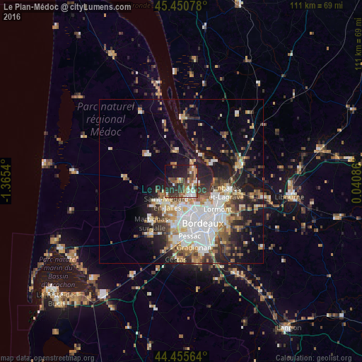
Analysis of Le Pian-Médoc night lights 2016
Square area 10x10 km:
 5.56%
5.56%90-99
6.98%80-89
3.65%70-79
2.7%60-69
9.37%50-59
9.05%40-49
9.84%30-39
12.86%20-29
14.76%10-19
18.57%0-9
6.67%Square area 50x50 km:
5.9%90-99
4.81%80-89
2.63%70-79
2.59%60-69
3.46%50-59
2.83%40-49
3.32%30-39
3.63%20-29
5.71%10-19
10.91%0-9
54.22%Clear (daylight) street map image can be seen on geolist.org.
Map coordinates:
45° 27' 2.8" North, 1° 21' 55.4" West
44° 57' 19.3" North, 0° 39' 44.2" West
44° 27' 20.3" North, 0° 2' 27.1" East
Some cities around Le Pian-Médoc sort by population:
• Saint-Médard-en-Jalles
8 km =5 mi,  215°
215°
• Eysines
8.1 km =5 mi,  171°
171°
• Blanquefort
5.2 km =3.2 mi,  157°
157°
• Bruges
9.3 km =5.8 mi,  154°
154°
• Le Haillan
9.3 km =5.8 mi,  188°
188°
• Le Taillan-Médoc
5.6 km =3.5 mi, 186°
• Parempuyre
4.6 km =2.9 mi,  96°
96°
• Saint-Aubin-de-Médoc
6.9 km =4.3 mi,  225°
225°
3002836 (p: 5,897)
Sources (retrieved 2019-11-25):
» Earth at Night: Flat Maps 2012, 2016