Pamiers night lights from space
Night Light of Pamiers (Occitanie) from space (France) Src. Average luminocity for 10x10km area is 22.8758% and for 50x50km: 3.524%.
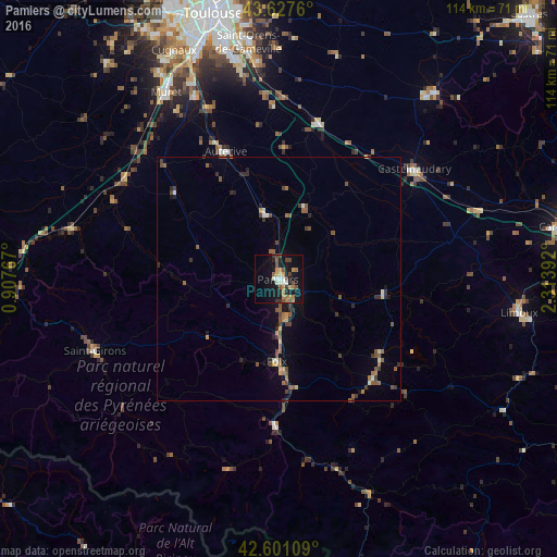
Analysis of Pamiers night lights 2016
Square area 10x10 km:
 1.06%
1.06%90-99
3.79%80-89
1.52%70-79
3.48%60-69
5.3%50-59
3.48%40-49
4.7%30-39
3.18%20-29
2.12%10-19
24.7%0-9
46.67%Square area 50x50 km:
0.12%90-99
0.33%80-89
0.22%70-79
0.38%60-69
0.58%50-59
0.96%40-49
0.9%30-39
0.63%20-29
0.69%10-19
1.68%0-9
93.52%Clear (daylight) street map image can be seen on geolist.org.
Map coordinates:
43° 37' 39.4" North, 0° 54' 27.6" East
43° 6' 59.4" North, 1° 36' 38.8" East
42° 36' 3.9" North, 2° 18' 50.1" East
Some cities around Pamiers sort by population:
• Muret
44.6 km =27.7 mi,  328°
328°
• Castelnaudary
35.8 km =22.2 mi,  51°
51°
• Foix
17.4 km =10.8 mi,  180°
180°
• Lavelanet
28.1 km =17.5 mi,  137°
137°
• Auterive
28.2 km =17.5 mi,  337°
337°
• Saint-Girons
40.5 km =25.2 mi,  248°
248°
• Escalquens
44.8 km =27.8 mi,  354°
354°
• Labarthe-sur-Lèze
41 km =25.5 mi, 335°
2988670 (p: 16,997)
Sources (retrieved 2019-11-25):
» Earth at Night: Flat Maps 2012, 2016