Escalquens night lights from space
Night Light of Escalquens (Occitanie) from space (France) Src. Average luminocity for 10x10km area is 40.5619% and for 50x50km: 22.8769%.
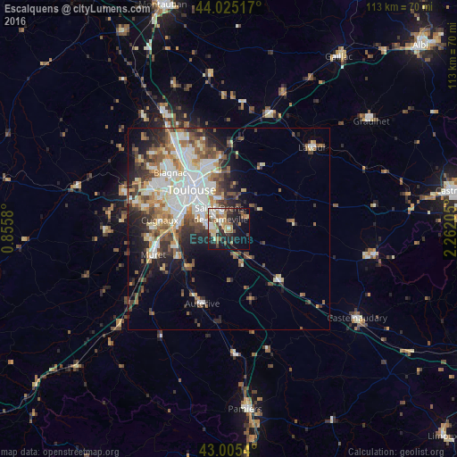
Analysis of Escalquens night lights 2016
Square area 10x10 km:
 3.81%
3.81%90-99
9.84%80-89
6.19%70-79
3.33%60-69
9.37%50-59
4.29%40-49
3.81%30-39
5.56%20-29
13.81%10-19
23.02%0-9
16.98%Square area 50x50 km:
4.9%90-99
5.12%80-89
2.53%70-79
2.28%60-69
2.95%50-59
3.09%40-49
3.27%30-39
3.08%20-29
4.87%10-19
6.78%0-9
61.12%Clear (daylight) street map image can be seen on geolist.org.
Map coordinates:
44° 1' 30.6" North, 0° 51' 20.9" East
43° 31' 2.8" North, 1° 33' 32.1" East
43° 0' 19.4" North, 2° 15' 43.4" East
Some cities around Escalquens sort by population:
• Toulouse
13.4 km =8.3 mi,  316°
316°
• Balma
11.5 km =7.1 mi,  335°
335°
• Saint-Orens-de-Gameville
4.5 km =2.8 mi,  333°
333°
• Ramonville-Saint-Agne
7.5 km =4.7 mi,  295°
295°
• L'Union
17 km =10.6 mi, 338°
• Castanet-Tolosan
4.9 km =3 mi,  267°
267°
• Portet-sur-Garonne
12.3 km =7.6 mi, 273°
• Labarthe-sur-Lèze
14.8 km =9.2 mi,  240°
240°
3019843 (p: 6,162)
Sources (retrieved 2019-11-25):
» Earth at Night: Flat Maps 2012, 2016