Orgeval night lights from space
Night Light of Orgeval (Île-de-France) from space (France) Src. Average luminocity for 10x10km area is 51.6776% and for 50x50km: 47.1935%.
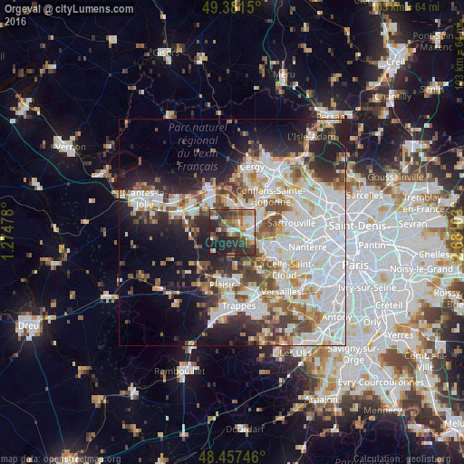
Analysis of Orgeval night lights 2016
Square area 10x10 km:
 8.1%
8.1%90-99
8.81%80-89
6.68%70-79
4.26%60-69
8.38%50-59
9.52%40-49
11.08%30-39
12.64%20-29
19.89%10-19
10.65%0-9
0%Square area 50x50 km:
15.59%90-99
11.56%80-89
3.98%70-79
4.01%60-69
4.84%50-59
4.34%40-49
5.55%30-39
4.92%20-29
8.27%10-19
11.37%0-9
25.58%Clear (daylight) street map image can be seen on geolist.org.
Map coordinates:
49° 22' 53.4" North, 1° 16' 29.2" East
48° 55' 17.8" North, 1° 58' 40.4" East
48° 27' 26.9" North, 2° 40' 51.7" East
Some cities around Orgeval sort by population:
• Poissy
5.3 km =3.3 mi,  81°
81°
• Verneuil-sur-Seine
5.9 km =3.7 mi,  350°
350°
• Carrières-sous-Poissy
5.5 km =3.4 mi,  55°
55°
• Triel-sur-Seine
6.6 km =4.1 mi,  18°
18°
• Vernouillet
5.5 km =3.4 mi,  2°
2°
• Chanteloup-les-Vignes
7.3 km =4.5 mi,  33°
33°
• Chambourcy
4.9 km =3 mi,  109°
109°
• Villennes-sur-Seine
2.4 km =1.5 mi, 24°
2989372 (p: 5,081)
Sources (retrieved 2019-11-25):
» Earth at Night: Flat Maps 2012, 2016