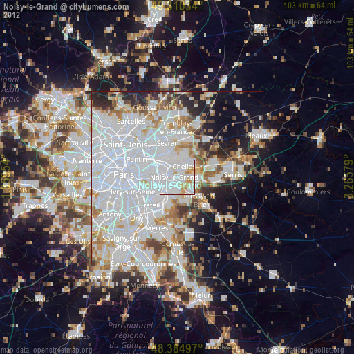
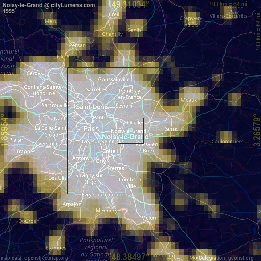
Noisy-le-Grand night lights from space
Night Light of Noisy-le-Grand (Île-de-France) from space (France) Src. Average luminocity for 10x10km area is 96.1577% and for 50x50km: 63.7327%.
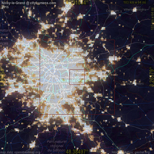

Analysis of Noisy-le-Grand night lights 2016
Square area 10x10 km:
 58.24%
90-99
28.27%80-89
5.68%70-79
4.12%60-69
3.69%50-59
0%40-49
0%30-39
0%20-29
0%10-19
0%0-9
0%Square area 50x50 km:
31.24%90-99
15.03%80-89
3.95%70-79
3.73%60-69
4.32%50-59
3.8%40-49
4.06%30-39
4.4%20-29
6.57%10-19
9.2%0-9
13.71%Clear (daylight) street map image can be seen on geolist.org.
Map coordinates:
49° 18' 37.2" North, 1° 51' 34.3" East
48° 50' 59.2" North, 2° 33' 45.6" East
48° 23' 5.9" North, 3° 15' 56.8" East
Some cities around Noisy-le-Grand sort by population:
• Chelles
4.1 km =2.5 mi,  32°
32°
• Gagny
4.3 km =2.7 mi,  330°
330°
• Neuilly-sur-Marne
1.1 km =0.7 mi,  293°
293°
• Villiers-sur-Marne
2.3 km =1.4 mi,  206°
206°
• Champs-sur-Marne
2.7 km =1.7 mi,  89°
89°
• Le Plessis-Trévise
4.4 km =2.7 mi,  169°
169°
• Bry-sur-Marne
3.1 km =1.9 mi,  244°
244°
• Gournay-sur-Marne
2.1 km =1.3 mi,  49°
49°
2990189 (p: 62,420)
Sources (retrieved 2019-11-25):
» NASA, Earths city lights 1995
» NASA city lights 2003
» Earth at Night: Flat Maps 2012, 2016