Louviers night lights from space
Night Light of Louviers (Normandy) from space (France) Src. Average luminocity for 10x10km area is 22.8209% and for 50x50km: 14.665%.
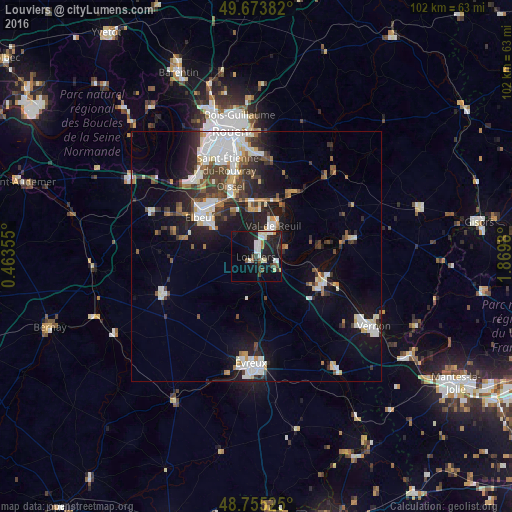
Analysis of Louviers night lights 2016
Square area 10x10 km:
 2.27%
2.27%90-99
6.02%80-89
2.94%70-79
1.2%60-69
1.07%50-59
2.81%40-49
1.6%30-39
2.27%20-29
7.35%10-19
27.01%0-9
45.45%Square area 50x50 km:
3.11%90-99
3.12%80-89
0.94%70-79
1.28%60-69
1.29%50-59
1.49%40-49
2.01%30-39
2.43%20-29
3.77%10-19
9.07%0-9
71.49%Clear (daylight) street map image can be seen on geolist.org.
Map coordinates:
49° 40' 25.8" North, 0° 27' 48.8" East
49° 13' 0" North, 1° 10' 0" East
48° 45' 18.9" North, 1° 52' 11.3" East
Some cities around Louviers sort by population:
• Elbeuf
14.2 km =8.8 mi,  303°
303°
• Val-de-Reuil
7.1 km =4.4 mi,  26°
26°
• Oissel
14 km =8.7 mi,  337°
337°
• Caudebec-lès-Elbeuf
12.7 km =7.9 mi, 304°
• Saint-Pierre-lès-Elbeuf
11.3 km =7 mi,  307°
307°
• Saint-Aubin-lès-Elbeuf
14.9 km =9.3 mi, 310°
• Gaillon
14 km =8.7 mi,  116°
116°
• Cléon
14.6 km =9.1 mi,  316°
316°
2997336 (p: 19,220)
Sources (retrieved 2019-11-25):
» Earth at Night: Flat Maps 2012, 2016