Caudebec-lès-Elbeuf night lights from space
Night Light of Caudebec-lès-Elbeuf (Normandy) from space (France) Src. Average luminocity for 10x10km area is 41.3503% and for 50x50km: 15.2705%.
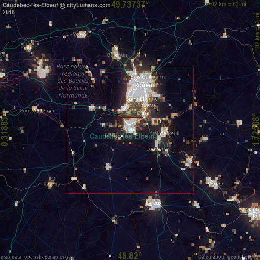
Analysis of Caudebec-lès-Elbeuf night lights 2016
Square area 10x10 km:
 9.49%
9.49%90-99
8.82%80-89
2.01%70-79
2.54%60-69
5.61%50-59
6.02%40-49
4.95%30-39
4.68%20-29
19.12%10-19
26.6%0-9
10.16%Square area 50x50 km:
3.53%90-99
3.11%80-89
1.04%70-79
1.18%60-69
1.38%50-59
1.73%40-49
2.13%30-39
2.68%20-29
4.22%10-19
7.71%0-9
71.27%Clear (daylight) street map image can be seen on geolist.org.
Map coordinates:
49° 44' 14.5" North, 0° 19' 7.8" East
49° 16' 51" North, 1° 1' 19" East
48° 49' 12" North, 1° 43' 30.3" East
Some cities around Caudebec-lès-Elbeuf sort by population:
• Saint-Étienne-du-Rouvray
12.4 km =7.7 mi,  29°
29°
• Elbeuf
1.5 km =0.9 mi,  295°
295°
• Oissel
7.8 km =4.8 mi,  41°
41°
• Grand-Couronne
8.4 km =5.2 mi,  352°
352°
• Petit-Couronne
11.4 km =7.1 mi,  358°
358°
• Saint-Pierre-lès-Elbeuf
1.5 km =0.9 mi,  97°
97°
• Saint-Aubin-lès-Elbeuf
2.7 km =1.7 mi,  341°
341°
• Cléon
3.5 km =2.2 mi,  8°
8°
3028214 (p: 10,104)
Sources (retrieved 2019-11-25):
» Earth at Night: Flat Maps 2012, 2016