Gaillon night lights from space
Night Light of Gaillon (Normandy) from space (France) Src. Average luminocity for 10x10km area is 18.2619% and for 50x50km: 11.6652%.
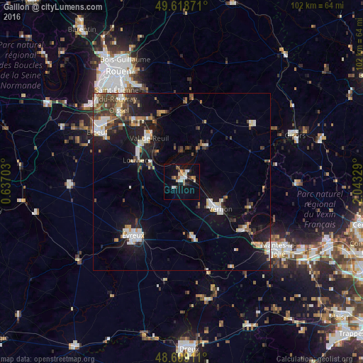
Analysis of Gaillon night lights 2016
Square area 10x10 km:
 2.52%
2.52%90-99
3.78%80-89
1.82%70-79
1.96%60-69
2.24%50-59
0.84%40-49
1.96%30-39
2.66%20-29
1.96%10-19
14.01%0-9
66.25%Square area 50x50 km:
1.69%90-99
2.33%80-89
0.93%70-79
1.22%60-69
1%50-59
1.08%40-49
1.83%30-39
1.97%20-29
3.01%10-19
9.36%0-9
75.57%Clear (daylight) street map image can be seen on geolist.org.
Map coordinates:
49° 37' 7.4" North, 0° 38' 13.3" East
49° 9' 39.7" North, 1° 20' 24.6" East
48° 41' 56.8" North, 2° 2' 35.8" East
Some cities around Gaillon sort by population:
• Évreux
20.5 km =12.7 mi,  222°
222°
• Vernon
11.7 km =7.3 mi,  130°
130°
• Louviers
14 km =8.7 mi,  296°
296°
• Val-de-Reuil
15.7 km =9.8 mi,  323°
323°
• Les Andelys
10.7 km =6.6 mi,  28°
28°
• Saint-Pierre-lès-Elbeuf
25.3 km =15.7 mi, 301°
• Saint-Marcel
10.5 km =6.5 mi, 130°
• Pacy-sur-Eure
16.4 km =10.2 mi,  168°
168°
3016807 (p: 6,818)
Sources (retrieved 2019-11-25):
» Earth at Night: Flat Maps 2012, 2016