Limoux night lights from space
Night Light of Limoux (Occitanie) from space (France) Src. Average luminocity for 10x10km area is 13.3302% and for 50x50km: 3.8439%.
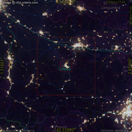
Analysis of Limoux night lights 2016
Square area 10x10 km:
 0.95%
0.95%90-99
1.59%80-89
3.17%70-79
0.63%60-69
3.81%50-59
0.32%40-49
2.86%30-39
0.63%20-29
0.63%10-19
2.22%0-9
83.17%Square area 50x50 km:
0.36%90-99
0.49%80-89
0.45%70-79
0.27%60-69
0.56%50-59
0.74%40-49
0.66%30-39
0.46%20-29
1.06%10-19
2.75%0-9
92.19%Clear (daylight) street map image can be seen on geolist.org.
Map coordinates:
43° 33' 59.4" North, 1° 31' 7" East
43° 3' 17.5" North, 2° 13' 18.2" East
42° 32' 20.2" North, 2° 55' 29.5" East
Some cities around Limoux sort by population:
• Carcassonne
20.5 km =12.7 mi,  30°
30°
• Pamiers
50.1 km =31.1 mi,  277°
277°
• Castelnaudary
36.4 km =22.6 mi,  323°
323°
• Mazamet
49.9 km =31 mi,  14°
14°
• Lézignan-Corbières
46.6 km =29 mi,  70°
70°
• Revel
48.2 km =30 mi,  338°
338°
• Lavelanet
33.5 km =20.8 mi,  245°
245°
• Trèbes
24.9 km =15.5 mi,  45°
45°
2998264 (p: 10,844)
Sources (retrieved 2019-11-25):
» Earth at Night: Flat Maps 2012, 2016