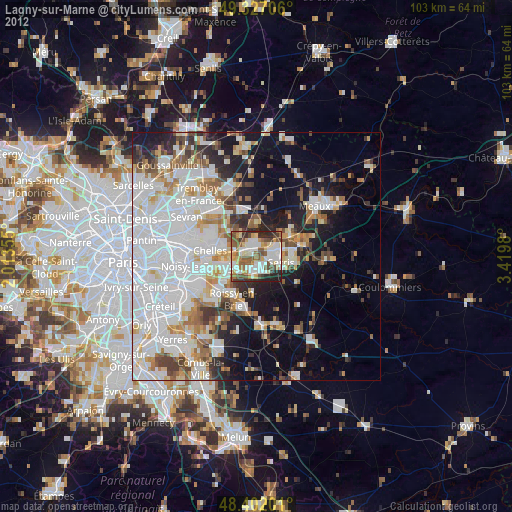
Lagny-sur-Marne night lights from space
Night Light of Lagny-sur-Marne (Île-de-France) from space (France) Src. Average luminocity for 10x10km area is 69.919% and for 50x50km: 44.4042%.
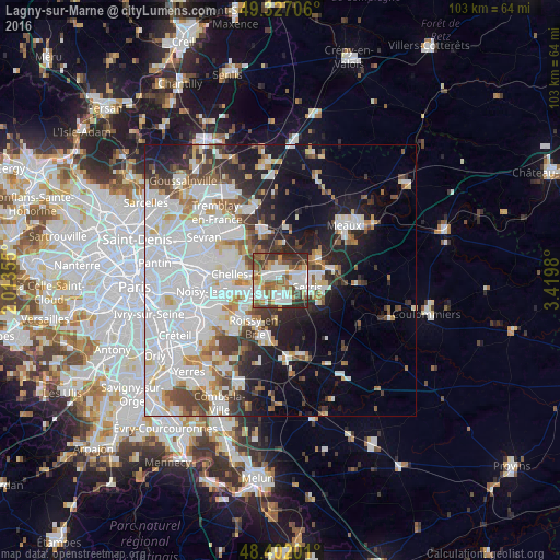
Analysis of Lagny-sur-Marne night lights 2016
Square area 10x10 km:
 19.03%
90-99
18.89%80-89
4.83%70-79
7.39%60-69
10.09%50-59
13.35%40-49
7.95%30-39
11.79%20-29
6.68%10-19
0%0-9
0%Square area 50x50 km:
18.39%90-99
10.24%80-89
3.11%70-79
2.73%60-69
3.54%50-59
3.4%40-49
4.1%30-39
4.18%20-29
6.14%10-19
11.28%0-9
32.89%Clear (daylight) street map image can be seen on geolist.org.
Map coordinates:
49° 19' 37.4" North, 2° 0' 48.8" East
48° 52' 0" North, 2° 43' 0" East
48° 24' 7.2" North, 3° 25' 11.3" East
Some cities around Lagny-sur-Marne sort by population:
• Torcy
5.1 km =3.2 mi,  249°
249°
• Lognes
7.2 km =4.5 mi,  241°
241°
• Noisiel
7 km =4.3 mi, 253°
• Vaires-sur-Marne
5.7 km =3.5 mi,  280°
280°
• Bussy-Saint-Georges
3.1 km =1.9 mi,  201°
201°
• Thorigny-sur-Marne
2.3 km =1.4 mi,  2°
2°
• Saint-Thibault-des-Vignes
2.7 km =1.7 mi, 280°
• Esbly
8.2 km =5.1 mi,  58°
58°
3009071 (p: 20,649)
Sources (retrieved 2019-11-25):
» Earth at Night: Flat Maps 2012, 2016