Huningue night lights from space
Night Light of Huningue (Grand Est) from space (France) Src. Average luminocity for 10x10km area is 61.5227% and for 50x50km: 18.498%.
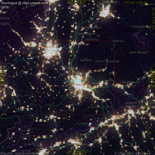
Analysis of Huningue night lights 2016
Square area 10x10 km:
 18.18%
90-99
15.06%80-89
3.13%70-79
5.54%60-69
7.39%50-59
11.51%40-49
6.53%30-39
9.66%20-29
14.63%10-19
8.38%0-9
0%Square area 50x50 km:
3.36%90-99
3.1%80-89
1.41%70-79
1.79%60-69
1.98%50-59
2.74%40-49
2.64%30-39
3.56%20-29
5.34%10-19
11.67%0-9
62.4%Clear (daylight) street map image can be seen on geolist.org.
Map coordinates:
48° 4' 36.1" North, 6° 52' 28.9" East
47° 36' 17.2" North, 7° 34' 40.2" East
47° 7' 42.8" North, 8° 16' 51.4" East
Some cities around Huningue sort by population:
• Basel, CH
5.2 km =3.2 mi,  183°
183°
• Lörrach, DE
6.6 km =4.1 mi,  80°
80°
• Weil am Rhein, DE
3.5 km =2.2 mi,  111°
111°
• Saint-Louis
2 km =1.2 mi,  224°
224°
• Riehen, CH
5.9 km =3.7 mi,  119°
119°
• Allschwil, CH
6.8 km =4.2 mi,  207°
207°
• Birsfelden, CH
6.7 km =4.2 mi,  149°
149°
• Efringen-Kirchen, DE
5.1 km =3.2 mi,  350°
350°
3012979 (p: 6,375)
Sources (retrieved 2019-11-25):
» Earth at Night: Flat Maps 2012, 2016