Gannat night lights from space
Night Light of Gannat (Auvergne-Rhône-Alpes) from space (France) Src. Average luminocity for 10x10km area is 2.1776% and for 50x50km: 3.0359%.
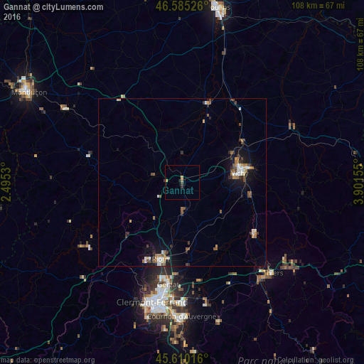
Analysis of Gannat night lights 2016
Square area 10x10 km:
 0%
0%90-99
0%80-89
0%70-79
1.14%60-69
0.57%50-59
0%40-49
0.14%30-39
1.28%20-29
0.14%10-19
0.43%0-9
96.31%Square area 50x50 km:
0.29%90-99
0.51%80-89
0.2%70-79
0.31%60-69
0.5%50-59
0.49%40-49
0.48%30-39
0.6%20-29
0.45%10-19
2.24%0-9
93.92%Clear (daylight) street map image can be seen on geolist.org.
Map coordinates:
46° 35' 6.9" North, 2° 29' 43.1" East
46° 5' 59.5" North, 3° 11' 54.3" East
45° 36' 36.6" North, 3° 54' 5.6" East
Some cities around Gannat sort by population:
• Vichy
17.8 km =11.1 mi,  80°
80°
• Riom
23.9 km =14.9 mi,  196°
196°
• Cusset
20.3 km =12.6 mi, 79°
• Gerzat
30.8 km =19.1 mi,  187°
187°
• Bellerive-sur-Allier
16 km =9.9 mi, 83°
• Cébazat
30.8 km =19.1 mi, 194°
• Châtel-Guyon
22.3 km =13.9 mi,  207°
207°
• Saint-Pourçain-sur-Sioule
24.1 km =15 mi,  16°
16°
3016711 (p: 6,096)
Sources (retrieved 2019-11-25):
» Earth at Night: Flat Maps 2012, 2016