Cusset night lights from space
Night Light of Cusset (Auvergne-Rhône-Alpes) from space (France) Src. Average luminocity for 10x10km area is 24.3665% and for 50x50km: 2.0947%.
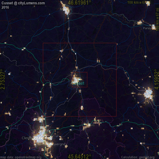
Analysis of Cusset night lights 2016
Square area 10x10 km:
 2.84%
2.84%90-99
5.97%80-89
1.42%70-79
2.84%60-69
4.97%50-59
2.7%40-49
2.98%30-39
3.84%20-29
2.41%10-19
25.57%0-9
44.46%Square area 50x50 km:
0.15%90-99
0.31%80-89
0.11%70-79
0.23%60-69
0.39%50-59
0.41%40-49
0.34%30-39
0.47%20-29
0.29%10-19
1.56%0-9
95.74%Clear (daylight) street map image can be seen on geolist.org.
Map coordinates:
46° 37' 10.6" North, 2° 45' 11.8" East
46° 8' 4.3" North, 3° 27' 23" East
45° 38' 42.4" North, 4° 9' 34.3" East
Some cities around Cusset sort by population:
• Vichy
2.5 km =1.6 mi,  250°
250°
• Riom
37.7 km =23.4 mi,  224°
224°
• Thiers
31.7 km =19.7 mi,  167°
167°
• Bellerive-sur-Allier
4.5 km =2.8 mi,  243°
243°
• Gannat
20.3 km =12.6 mi,  259°
259°
• Châtel-Guyon
38.4 km =23.9 mi,  232°
232°
• Saint-Pourçain-sur-Sioule
23.1 km =14.4 mi,  326°
326°
• Lezoux
34.7 km =21.6 mi,  189°
189°
3021993 (p: 14,562)
Sources (retrieved 2019-11-25):
» Earth at Night: Flat Maps 2012, 2016