Fleurance night lights from space
Night Light of Fleurance (Occitanie) from space (France) Src. Average luminocity for 10x10km area is 3.6476% and for 50x50km: 1.5747%.
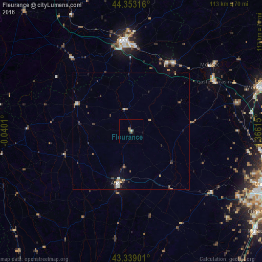
Analysis of Fleurance night lights 2016
Square area 10x10 km:
 0.32%
0.32%90-99
0.32%80-89
0%70-79
1.27%60-69
0%50-59
1.27%40-49
0.79%30-39
0.63%20-29
0.48%10-19
0.95%0-9
93.97%Square area 50x50 km:
0.13%90-99
0.26%80-89
0.14%70-79
0.14%60-69
0.21%50-59
0.3%40-49
0.3%30-39
0.43%20-29
0.31%10-19
0.55%0-9
97.23%Clear (daylight) street map image can be seen on geolist.org.
Map coordinates:
44° 21' 11.4" North, 0° 2' 24.4" West
43° 50' 53.7" North, 0° 39' 46.9" East
43° 20' 20.4" North, 1° 21' 58.1" East
Some cities around Fleurance sort by population:
• Agen
39.2 km =24.4 mi,  355°
355°
• Auch
23.3 km =14.5 mi,  194°
194°
• Castelsarrasin
41.5 km =25.8 mi,  59°
59°
• Le Passage
39.6 km =24.6 mi,  353°
353°
• Condom
26.3 km =16.3 mi,  297°
297°
• Nérac
41.2 km =25.6 mi,  321°
321°
• Bon-Encontre
37.5 km =23.3 mi,  0°
0°
• Valence
34.2 km =21.3 mi,  32°
32°
3018323 (p: 6,564)
Sources (retrieved 2019-11-25):
» Earth at Night: Flat Maps 2012, 2016