Condom night lights from space
Night Light of Condom (Occitanie) from space (France) Src. Average luminocity for 10x10km area is 5.4222% and for 50x50km: 1.896%.
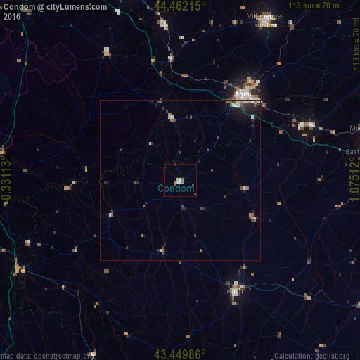
Analysis of Condom night lights 2016
Square area 10x10 km:
 0.32%
0.32%90-99
1.27%80-89
0.95%70-79
0.32%60-69
0.79%50-59
1.43%40-49
1.27%30-39
0.32%20-29
0%10-19
0%0-9
93.33%Square area 50x50 km:
0.21%90-99
0.27%80-89
0.15%70-79
0.11%60-69
0.27%50-59
0.27%40-49
0.42%30-39
0.46%20-29
0.61%10-19
1.18%0-9
96.05%Clear (daylight) street map image can be seen on geolist.org.
Map coordinates:
44° 27' 43.7" North, 0° 19' 52.1" West
43° 57' 29.4" North, 0° 22' 19.2" East
43° 26' 59.5" North, 1° 4' 30.4" East
Some cities around Condom sort by population:
• Agen
33.7 km =20.9 mi,  37°
37°
• Auch
38.9 km =24.2 mi,  153°
153°
• Le Passage
32.7 km =20.3 mi,  34°
34°
• Nérac
20 km =12.4 mi,  352°
352°
• Fleurance
26.3 km =16.3 mi,  117°
117°
• Bon-Encontre
34.6 km =21.5 mi, 43°
• Foulayronnes
38.2 km =23.7 mi, 34°
• Valence
44.7 km =27.8 mi,  68°
68°
3023943 (p: 7,732)
Sources (retrieved 2019-11-25):
» Earth at Night: Flat Maps 2012, 2016