Berck night lights from space
Night Light of Berck (Hauts-de-France) from space (France) Src. Average luminocity for 10x10km area is 13.7493% and for 50x50km: 1.9907%.
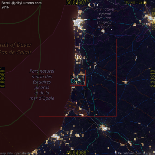
Analysis of Berck night lights 2016
Square area 10x10 km:
 0%
0%90-99
0.56%80-89
0%70-79
1.68%60-69
3.92%50-59
4.76%40-49
4.06%30-39
2.38%20-29
3.08%10-19
2.8%0-9
76.75%Square area 50x50 km:
0.09%90-99
0.2%80-89
0.18%70-79
0.14%60-69
0.4%50-59
0.42%40-49
0.45%30-39
0.44%20-29
0.31%10-19
0.71%0-9
96.68%Clear (daylight) street map image can be seen on geolist.org.
Map coordinates:
50° 50' 45.9" North, 0° 53' 48.8" East
50° 24' 0" North, 1° 36' 0" East
49° 56' 58.9" North, 2° 18' 11.3" East
Some cities around Berck sort by population:
• Boulogne-sur-Mer
36.2 km =22.5 mi,  1°
1°
• Outreau
34 km =21.1 mi,  358°
358°
• Étaples
13.8 km =8.6 mi,  9°
9°
• Le Portel
34 km =21.1 mi, 357°
• Le Touquet-Paris-Plage
13.9 km =8.6 mi, 355°
• Desvres
34.2 km =21.3 mi,  29°
29°
• Saint-Étienne-au-Mont
31 km =19.3 mi, 4°
• Cucq
8.7 km =5.4 mi, 9°
3033415 (p: 15,609)
Sources (retrieved 2019-11-25):
» Earth at Night: Flat Maps 2012, 2016